 |
European Planetary Science Congress 2012
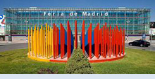
IFEMA-Feria de Madrid
23 – 28 September 2012, Madrid, Spain |
 |
|
MT1 Advances in Planetary Mapping, Remote Sensing and Data Mining |
| Convener: Anthony Cook | Co-Convener: Konrad Willner |
|
Oral Program
/ Tue, 25 Sep, 14:30–18:00
/ Room Venus
Poster Program
/ Attendance Tue, 25 Sep, 18:15–19:45
/ Poster Area
|
Current and future international planetary missions have a large diversity of sensors that return vast amounts of planetary data. What new cartographic, remote sensing and data handling techniques will help us make sense of this data flood? This session aims to find answers to questions such as: (1) how can automated feature detection and recognition algorithms be utilized for data-mining and automatic inclusion into a GIS database? (2) What are the accuracies and limitations of processed cartographic products, especially in terms of spatial registration of different remote sensing datasets together? (3) How can GIS systems assist in mission planning and evaluation of data? (4) How to visualize planetary data products for most effective science exploitation?
| Public information: | The application of automated planetary mapping, GIS, and remote sensing techniques to planetary surfaces. |

