
 1,1,2,1,1,1
- 1Open University, School of Physical Sciences, School of Physical Sciences, Open University, Walton Hall, Milton Keynes MK7 6AA, UK (elena.favaro@open.ac.uk)
- 2Department of Earth Sciences, Natural History Museum, London, UK
Introduction
In 2023 the Rosalind Franklin rover will land on Mars at Oxia Planum, as part of the European Space Agency’s ExoMars programme. Transverse Aeolian Ridges (TARs), periodic bedrock ridges (PBRs), dust devils, dust devil tracks, and/or windstreaks are common within the rover’s landing ellipse. These aeolian features can be used to characterize the paleo and contemporary aeolian environment of the landing region before the start of rover operations. Here we present new measurements of the orientation, morphologies, and directionality of TARs, PBRs, windstreaks, and active dust devils, in order to better understand the wind regime at the landing site, on a continuum of spatial and temporal scales.
Methods
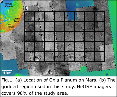
We used machine learning (Novelty or Anomaly Hunter – HiRISE [NOAH-H])[1] and manual mapping-derived TAR and PBR distributions, as well as feature orientation and crest-line lengths to elucidate regional wind patterns in a 640 km2 area of Oxia Planum (Fig.1). The area was gridded into 160 four km2 quadrants, with every second quadrant analyzed. TAR crestlines were manually digitized as continuous and discontinuous ripples, based on NOAH-H ontological classes (Barrett et al., in prep). Continuous ripples are found at a variety of scales (metres to tens of metres in across-bedform length) and consist of patches of parallel ripples which merge into one another. Discontinuous ripples are features in which the aeolian bedforms are separated by areas of non-aeolian material, including those that are isolated on the surface and those which form part of a sparse patch overlying any non-aeolian material. PBRs were identified based on NOAH-H bedrock classes, as well as their morphology and texture, similar to PBRs found elsewhere on Mars[2] and Earth[3].
We used multiple change detection techniques on HiRISE, HRSC, and CaSSIS imagery to determine migration rates of TARs and to track active dust devils and analyze wind streaks [4-8].
Results and Discussion
We digitized the crestlines of 7989 continuous ripples and 2764 discontinuous ripples. TAR along-crestline lengths range from 1.1 m to 556 m. Meter-scale TARs are common across the study area but decameter-scale TARs are uncommon, and are primarily found in topographic lows. Irrespective of the scale of the bedform, we found crestline azimuths to be consistent across the study area. Based upon terrestrial megaripple research using the difference in albedo to determine the stoss and lee slopes of ripples in the Argentinian Puna[9], coupled with the crestline azimuths determined from digitizing the landforms, we posit that the winds responsible for the expression of TARs in Oxia Planum blew from the NW-NNW towards the SE-SSE (Fig.2). Crestlines for 457 PBRs were digitized, and found to be longer than TAR crestline-lengths: PBRs have ridge-crests that range in length from ~4 m to just over 600 m. Azimuths of PBRs were found to be substantially different than TARs, requiring winds to have blown from the N-NNE or the S-SSE, accounting for 180° ambiguity. However, analysis of coregistered and orthorectified repeat HiRISE imagery over 11 Earth years showed no appreciable movement in TAR fields in the study area.
Two active dust devils were identified in the study area using HRSC images. One dust devil moved from the NW to the SE, while the second travelled from the SW to the NE. From a pair of CTX images taken 50 Earth days apart, 6 active dust devils and 649 dust devil tracks and/or windstreaks were identified. The features are predominantly oriented in a WNW-ESE direction with a secondary NEN-SWS noted for a few of the tracks (Fig.2).
The computed azimuths for TARs, PBRs, dust devils and dust devil tracks and/or windstreaks are markedly different (Fig.2), suggesting that different formative winds would have been necessary to result in the directionality of bedforms, landforms, and dust devils we currently see in Oxia Planum. These results pose important questions about the wind regime in this area. When were the winds responsible for TARs and PBRs active? And if contemporary winds are not responsible for TAR and PBR orientation, when did the wind regime shift? To begin answering these questions, our work will focus on comparing the results from this morphological study with modelled climate data in order to help determine when and why the wind regime changed.

Looking forwards to the surface mission, the surface platform for the Rosalind Franklin rover will carry a meteorological package that will provide in situ wind measurements. We can compare those data to our morphologically- and modelled-derived results. The rover itself will be able to analyze the granulometry of TARs and the bedrock strata of PBRs using imaging data, further assisting us to characterize the winds from a geomorphological standpoint. These datasets will provide further understanding of the aeolian regime of the Oxia Planum area and provide valuable insight into the climatic history of Mars.
References
[1] Barrett et al. (In Prep). NOAH-H, a deep-learning, terrain analysis system: results for the ExoMars Rover candidate landing sites.
[2] Montgomery et al. (2012). Journal of Geophysical Research: Planets, 117(E3).
[3] Hugenholtz et al. (2015). Aeolian Research, 18, 135-144.
[4] Balme et al. (2008). Geomorphology, 101(4), 703-720.
[5] Greeley et al. (2004). Geophysical research letters, 31(24).
[6] Leprince et al. (2007). IEEE Transactions on Geoscience and Remote Sensing, 45(6), 1529-1558.
[7] Reiss et al. (2011). Icarus, 215(1), 358-369.
[8] Grindrod et al (2018). Journal of Geophysical Research: Planets, 123(7), 1881-1900.
[9] Favaro et al. (2020). Icarus, 113765.
How to cite: Favaro, E. A., Balme, M. R., Davis, J., Grindrod, P. M., Fawdon, P., Barrett, A. M., and Lewis, S. R.: Aeolian Signals from landforms and bedforms at the Landing Site for the ExoMars Rosalind Franklin Rover in Oxia Planum, Mars, Europlanet Science Congress 2020, online, 21 Sep–9 Oct 2020, EPSC2020-572, https://doi.org/10.5194/epsc2020-572, 2020.