
Presentation of the new web interface of MarsSI, the martian surface data service

- CNRS/Université de Lyon, Observatoire de Lyon, Villeurbanne, France (matthieu.volat@univ-lyon1.fr)
Geological investigations of planetary surfaces require the combination of orbital datasets. Missions being often multiple-instruments platforms from multiple space agencies, the quantity of data available increased quickly.
MarsSI [3] is a platform designed to explore, calibrate, process and retrieve Mars orbital data. It was certified in 2017 as french national Research Infras- tructure by the Centre National de la Recherche Scientifique (CNRS) as part of the Planetary Surface Portal (PSUP) [2].
As of 2021, it indexes the optical (visible, multi and hyper-spectral) data from the recent orbiter missions, and allow to request the creation of Digital Elevation Models on demand. The focus, as highlighted by figure 1 is to allow the user to browse and request ”ready-to-use” products in regards of calibration, refinements and georeferencing. The user will be able to visualize and interpret the data in GIS or remote sensing software.
We are now presenting the new web interface that was introduced in a beta phase to the users in may 2021.
Overview
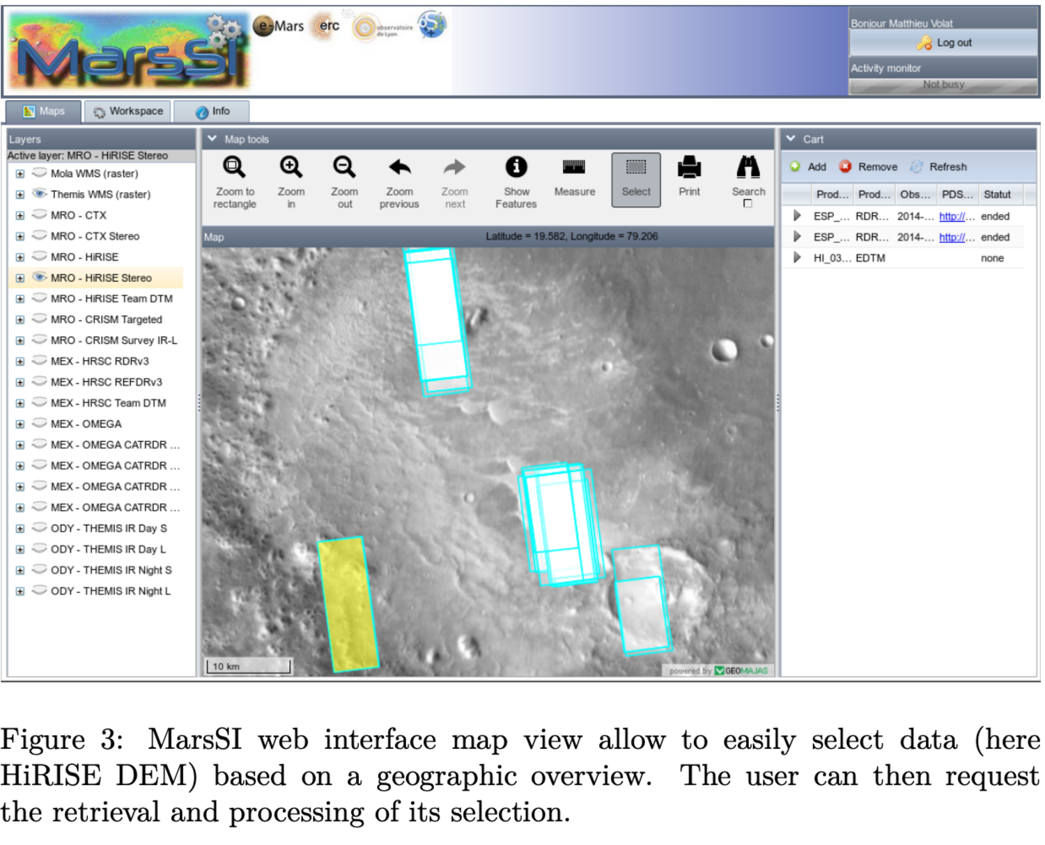
MarsSI original web interface was based on Geomajas (www.geomajas. org), a free and open source GIS toolkit. This allowed us to build an interface consisting in a map view to display and select products to be added to a workspace. A seperatate view would allow to request actions regarding the products in the workspace, such as “download”, “process”, “copy”.
With time, we however have recognized the limitation of this toolkit. Developpement slowed down on the upstream project, and we found very hard to continue coding the whole project in Java. Client-side code was proving to be less and less compatible with web browsers, and did not allow use to natively use newer features that would either ease coding or improve user experience. Server-side code was very ressource-consuming, hard to debug and support for newer java version was inexistant for certain libraries.
New version
We selected to rely on the Python Django framework (www.djangoproject.com) to build our new web interface. This choice was motivated by the maturity of the project, the ease of developpement, configuration and deployment and safe dependency management. The design was based to use just the Javascript code necessary and not more : we elected to rely on the Leaflet framework to provide WebGIS functionnality due to being able to use our already-existing OGC backends. As of 2019, it was only the only framework we found to be able to use custom projections, something needed for planetary GIS.
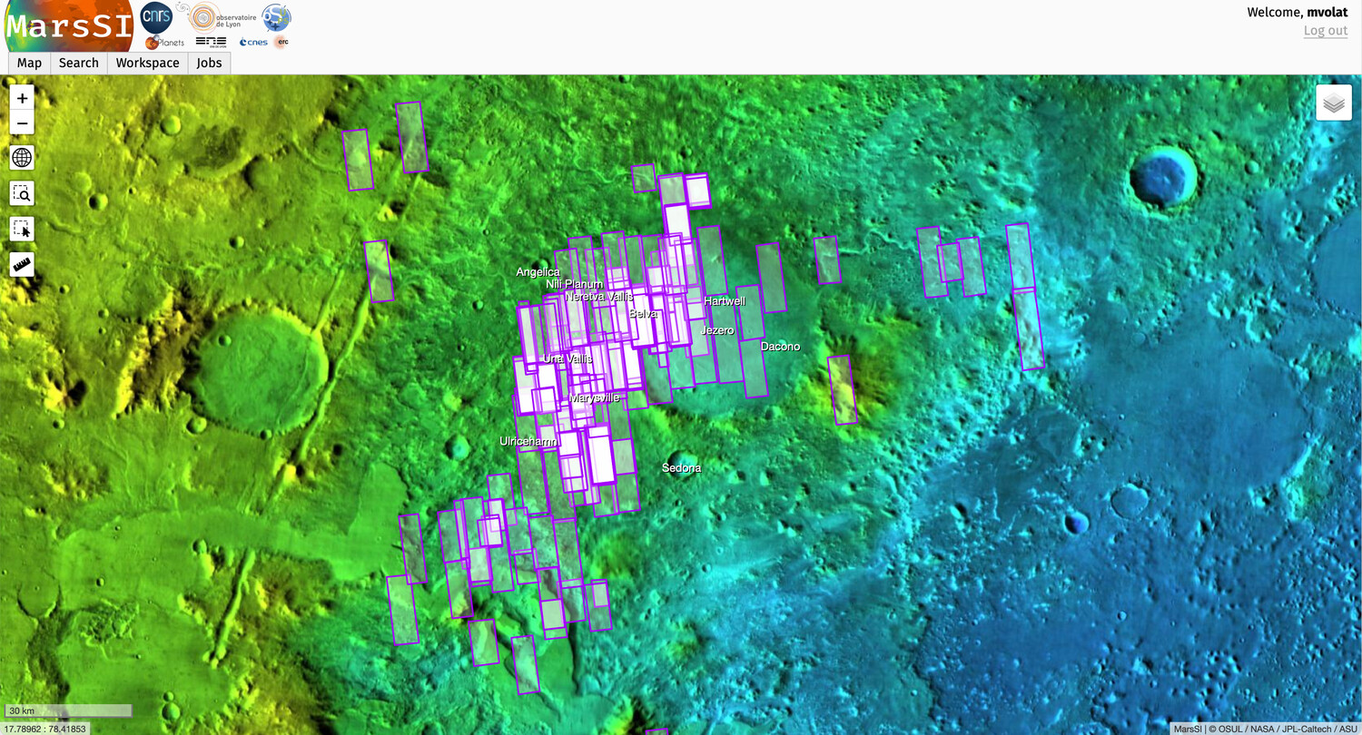
Design-wise, we chose a simplified view, but kept a lot of the functionnal concepts of the previous version that were still relevant. We kept a system of tabs to switch between a Map view, a Workspace view and a Job view.
Our new map view maximise the space allocated to the map. We also created a new, better background layer of composite THEMIS/MOLA. The Murray Lab global CTX mosaic was also added as a background layer, as well as a nomenclature layer to display the IAU labels. Users will be able, as before, to display, select and add footprint to their workspace from there. We elected not to duplicate the workspace view in this tab.
 `
`
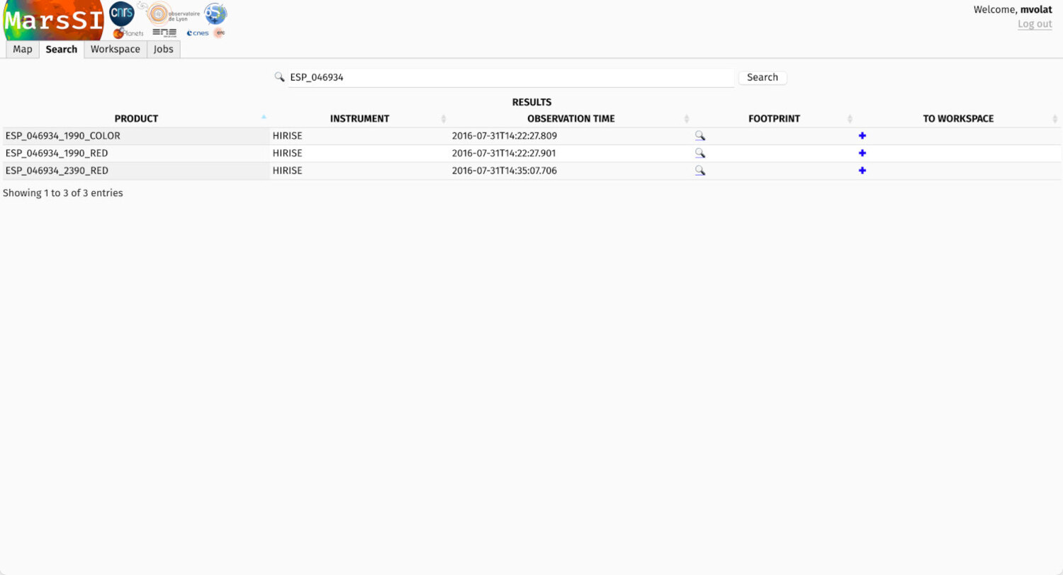
The search view is still a work in progress: we separated this functionnality in a tab that allow freetext search to return results. Footprints can be previewed from there, and product can also be added to provide minimal functionnality, but we expect to work more on this part in the near future.
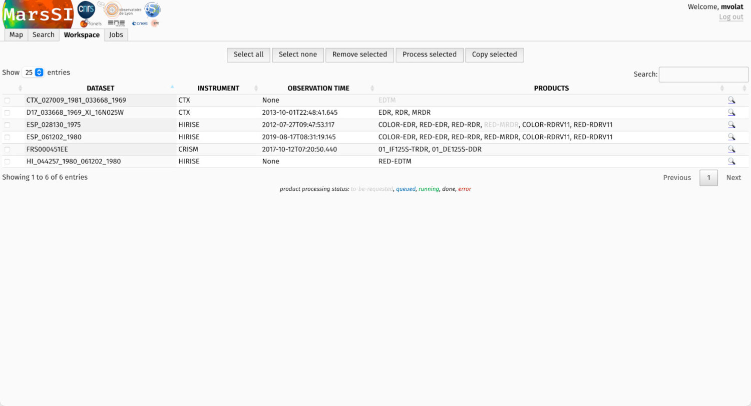
The workspace view is a consolidated view of the product selection. We present a table allowing to display some informations on the datasets, a footprint overwiew, some basic facilities to sort and search the entries. Products availability is displayed with a color code indicating the availability of the subproducts of an entry (for exemple, for an image: the raw EDR data, calibrated RDR, projected MRDR, etc). It is also from the workspace the user will select and request data processing or copy to its SFTP directory.
The job view allow to concentrate on the requests the user specified. Using the REST interface provided by our cluster batch management system, OAR (https://oar.imag.fr), it is a close view of MarsSI computationnal facilities. We also hope to develop this view to help understand better product processing.
We chose to not to try to integrate the wiki that can still be accessed as a separate page. A “getting started” page explain the basics of the new interface, other specific pages will be updated when this new “Django” version is MarsSI default web interface.
Conclusion and perspectives
We built a new interface to display and browse MarsSI catalog, request dataset processing and copies. This new interface make use of both web and cartographic standards to provide an elegeant and reliable service that also paves the way for more improvements.
We plan to improve usability both in map and search view, espcially when there is a great number of products to display. We are also already working on “context” views to present Mars polar view and display other planetary surfaces, and extend our facility beyond Mars.
How to cite: Volat, M. and Quantin-Nataf, C.: Presentation of the new web interface of MarsSI, the martian surface data service, European Planetary Science Congress 2021, online, 13–24 Sep 2021, EPSC2021-186, https://doi.org/10.5194/epsc2021-186, 2021.