- 1Laboratoire de Planétologie et Géosciences, CNRS UMR 6112, Nantes Université, Université d'Angers, Université du Mans, Nantes, France (stephane.lemouelic@univ-nantes.fr)
- 2Dept of Engineering Physics, Univ. Wisconsin-Madison, P.O. Box 90730, Albuquerque, NM 87199, USA
- 3IRAP, UMR 5277 CNES, UPS, CNRS, Toulouse, France
The Apollo 17 manned mission landed in the Taurus Littrow valley on the Moon in December 1972. The geology of this site, on the eastern edge of Mare Serenitatis, was thoroughly investigated during extra vehicular activities performed during three days spent at the surface [1, 2]. A total of 111 kg of well-documented rock and soil samples were collected and brought back to Earth during this last Apollo mission. Among several waypoints of interest, astronauts spent more than one hour to investigate five large boulder fragments at Station 6, lying at the base of a long boulder trail descending from the North Massif. These boulders might originate in material emplaced as a result from the ejected melt sheet from the Crisium impact event [2], or Serenitatis impact event [3, 4]. In a recent study [5], we used scanned photographs taken in situ with astronaut’s Hasselblad cameras to reconstruct a 3D model of each of the boulders using photogrammetry techniques [6].
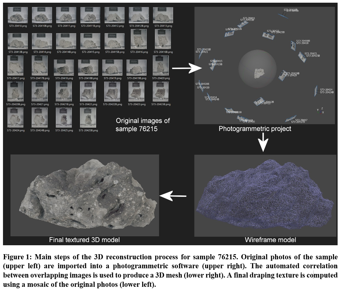
In addition to the 3D reconstruction of the boulders themselves reported in [5], we pushed the reconstruction process one step further by taking advantage of the fact that the rock samples hammered from the boulders at Station 6 were thoroughly documented once brought back on Earth in the Lunar Receiving Lab facility in Houston. In particular, several stereoscopic photographic pairs were systematically acquired for a significant number of the samples. When a sufficient number of viewpoints have been acquired, this potentially allows a complete photogrammetric 3D reconstruction of the rocks themselves. We used as input original photographs available on the Lunar and Planetary Institute website (https://www.lpi.usra.edu/lunar/samples/atlas/). We first performed a color balancing of the scans of these photos. Then, masks corresponding to a detouring of the rocks were applied to avoid errors induced by the fixed background in the photogrammetric project. By manually adding tie points, we were able to compute a detailed textured 3D model of sample 76315 (a micropoikilitic impact melt breccia), sample 76215 (a vesicular micropoikilitic impact melt breccia), and sample 76015 (another vesicular micropoikilitic impact melt breccia, which was chipped off top corner of Block 5 of the big boulder at Station 6). The full reconstruction process is illustrated in Fig. 1 for sample 76215.

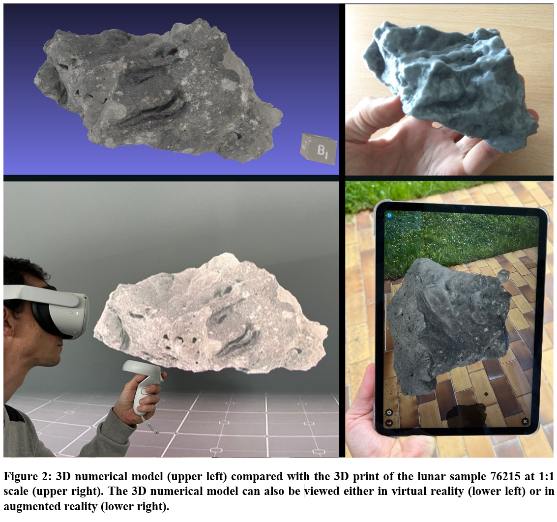
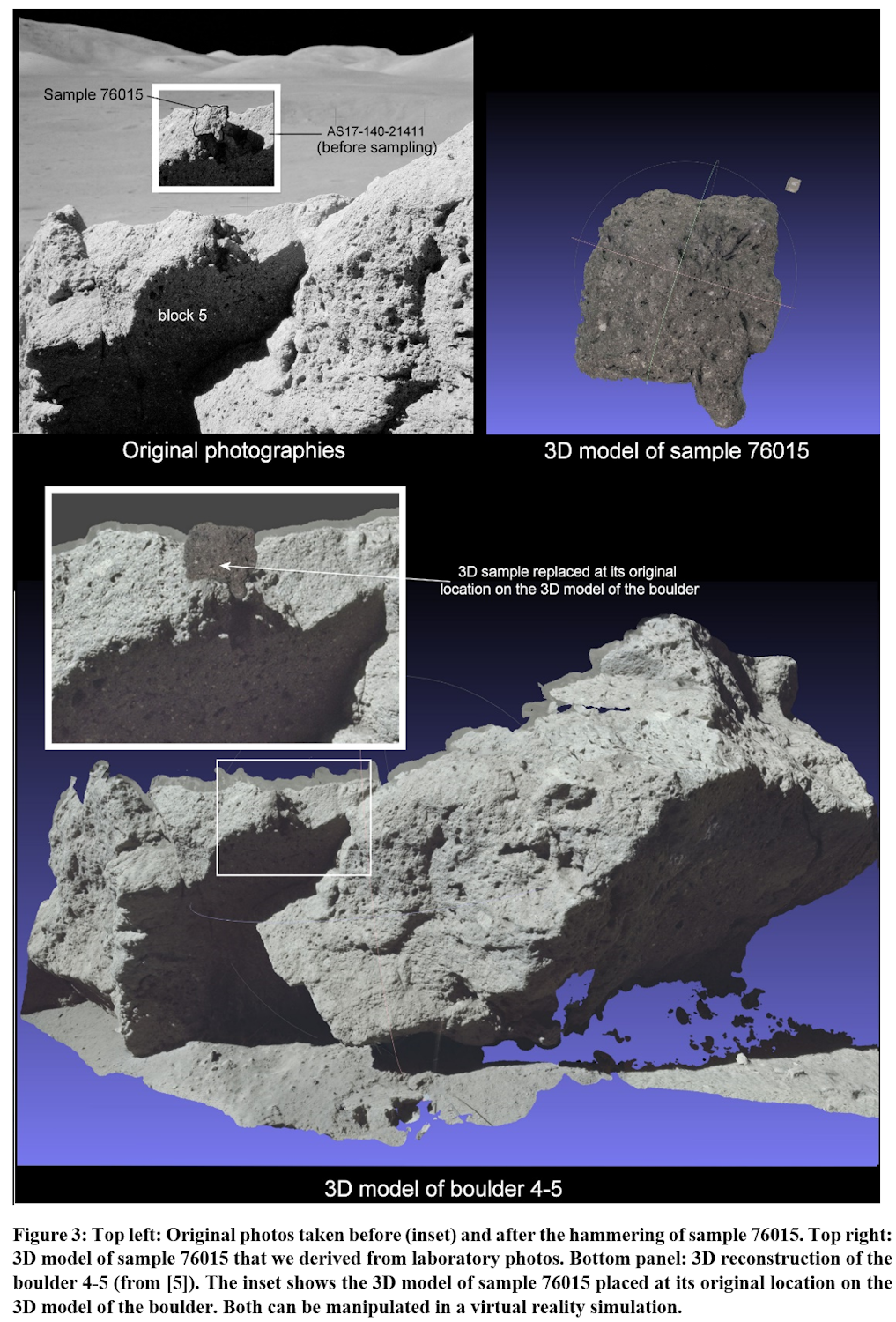
We have posted the 3D models of these samples on the Sketchfab web platform at https://sketchfab.com/LPG-3D to allow their easy visual inspection. These 3D models are of particular interest as these lunar samples have been broken into multiple pieces after being photographed. The 3D numerical model can therefore be thought as a kind of historical heritage of the original rocks, which do not exist anymore in their original form. Using this reconstruction, we can obtain a copy of the shape of these original rocks using a 3D-Printer (Fig. 2). They can also be viewed using augmented reality, with a cellphone or a tablet, or even manipulated in virtual reality on Sketchfab using a VR headset (Fig 2). From a more scientific point of view, the 3D models theoretically allow to replace the samples in their original position and orientation directly on the 3D models of the original boulders themselves (Fig 3). This is of particular interest to retrieve the precise original orientation of the sample, to investigate for example the characteristics of coatings. On sample 76015, at least three different units show various degree of alteration, which can be correlated with the original position of the sample with respect to its environment. The upper sky-facing side is the most affected by space weathering effects, with a well-developed patina. On its lower edge, a less altered face protected by a crevice might correspond to a lower alteration degree developed during only 20 million years, the approximate age of the impact generating the fall of the boulders from the North Massif slopes according to radiogenic dating.

References :
[1] Wolfe, E.W. et al. Geologic investigation of the Taurus-Littrow Valley: Apollo 17 landing site. U.S. Geol. Survey. Prof. Pap. 1981, 1080, 225–280., 1981
[2] Schmitt, H.H. et al., Revisiting the field geology of Taurus-Littrow. Icarus 2017, 298, 2–33, doi:10.1016/j.icarus.2016.11.042, 2017.
[3] Spudis, P. D., and G. Ryder, Apollo 17 impact melts and their relation to the Serenitatis basin, Proc. Lunar Planet. Sci. Conf., 12th, 133–148, 1981.
[4] Hurwitz and Kring, Identifying the geologic context of Apollo 17 impact melt breccias, Earth and Planetary Science Letters, 436, 64–70, 2016.
[5] Le Mouélic, S. et al. Investigating Lunar Boulders at the Apollo 17 Landing Site Using Photogrammetry and Virtual Reality, Remote Sensing, 12 (11), DOI: 10.3390/rs12111900, 2020.
[6] Favalli, M. et al., Multiview 3D reconstruction in geosciences. Comput. Geosci. 2012, 44, 168–176, 2012.

How to cite: Le Mouélic, S., Macquet, L., Schmitt, H., Mangold, N., Caravaca, G., Seignovert, B., and Le Menn, E.: 3D reconstruction of lunar rock samples collected at North Massif Station 6 during the Apollo 17 mission , Europlanet Science Congress 2022, Granada, Spain, 18–23 Sep 2022, EPSC2022-348, https://doi.org/10.5194/epsc2022-348, 2022.

