A weather modelling software toolkit for planetary science applications
- 1Space Science and Technology Centre, Curtin university, Australia
- 2International Centre for Radio Astronomy Research, Curtin university, Australia
- 3Curtin Institute for Data Science, Curtin university, Australia
- 4The Norwegian Meteorological Institute, Norway
Fine resolution atmospheric models are used for a suite of planetary science applications, from the prediction of meteorite or human-made object fall locations, to modelling infrasound wave propagation. No matter the application, the research team typically needs to ask an expert from a local meteorological institute/bureau for such weather model data. This may be suitable for ad hoc cases, but is not suitable for routine use. On top of that, there still might be delays that would impact time sensitive uses, for example precipitation causing contamination of a recent meteorite fall. While building the Desert Fireball Network (DFN), including an automated data processing pipeline, we decided to invest into an in-house weather modelling knowledge base and solution.
The luminous flight of fireballs typically ends at tens of kilometres altitude, and there is always a need to model a potential meteorites’ fall to the ground.
The dark flight modelling is a straightforward physical simulation, though is significantly influenced by the winds. The wind can blow the re-entering object many kilometres away from idealistic no—wind calculation. As a realistic search area covers only several square kilometres, ignoring the winds in the dark flight simulation could result in founding no meteorites at all. In some rare cases, there is a direct measurement of the weather state available - a vertical profile from a radiosonde on a balloon, launched nearby and recording at the time of the fireball. But in most scenarios, weather modelling is the only method to provide the atmospheric data needed for a successful fall location prediction leading to meteorite recovery.

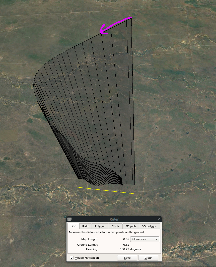
Figure 1: Modelled flight path of 5g meteorite entering atmosphere in opposite direction with respect to the dominant wind direction, visualised in Google Earth.
We have developed a software toolkit to model weather conditions in a given area and time range in the past, using state of the art, freely available weather modelling software (WRF-ARW), configured for high temporal and spatial resolution.
We have been using and re-fining this method for a decade and the software has contributed to over 13 successful meteorite recoveries within Australian DFN and Global Fireball Observatory (GFO). As the number of meteorite- dropping fireballs captured by DFN and GFO was growing, and based on requests from our overseas collaborators to run modelling for their cases, we have recently refactored this software into a more user-friendly form and further automated the workflow, lowering the entry threshold for users who are not experts in weather simulations and meteorology. It allows the weather simulation to be run remotely, either on a Linux based system (both virtual and physical) or on an HP/Cray supercomputer. The functionality includes collecting the data product from the remote system to a local disk.
On top of dark flight calculation for meteorite recovery, the weather model toolkit has successfully been used in scenarios such as:
- Tracking re-entry of sample return space mission capsule,
- To mitigate risk of interaction of the public with potentially hazardous space debris deorbiting out of control and to locate and collect evidence of “space littering,”
- To track trajectory of stratospheric balloon descent for spacecraft test flights.
It could also be used to support other planetary science areas, including acoustic wave propagation or density and temperature dispersion models.
The software is on Github and will be made publicly available (at the time of the congress), with instructions on how to use and configure for scenarios we have experienced. The weather modelling toolkit is complementary with dark flight modelling software that has previously been published by our team (also with code publicly available on Github).
We are planning to offer the weather modelling as an automated public service for researchers, providing we secure funding for a web app interface and long-term maintenance/operations.

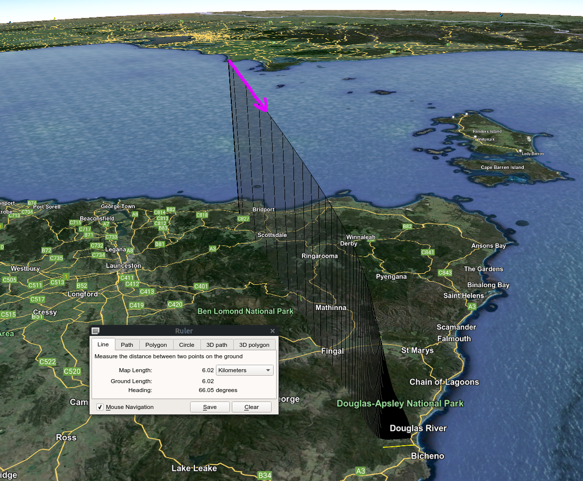
Figure 2: Modelled flight path of 1kg fragment of Soyuz spacecraft deorbiting in a direction approximately perpendicular to the dominant wind direction, visualised in Google Earth.
References
Skamarock, W. C., Klemp, J. B., Dudhia, J., et al. 2019, A description of the advanced research WRF version 4, Tech. rep., NCAR Technical Note NCAR/TN-556+STR, doi: 10.5065/1dfh-6p97
Towner, M. C., Jansen-Sturgeon, T., Cupák, M., et al. 2022, PSJ, 3, 44, doi: 10.3847/PSJ/ac3df5
Howie, R. M., Paxman, J., Bland, P. A., et al. 2017a, Experimental Astronomy, 43, 237, doi: 10.1007/s10686-017-9532-7
Devillepoix, H. A. R., Cupák, M., Bland, P. A., Sansom, E. K., Towner, M. C., Howie, R. M., ... & Benedix, G. K. (2020). A Global Fireball Observatory. Planetary and Space Science 191:105036
DFN team page with contact information to request atmospheric modelling: https://dfn.gfo.rocks/data_code.html
How to cite: Cupak, M., Sansom, E., Devillepoix, H., Towner, M., Kompella, S., Hancock, P., and Singleton, A.: A weather modelling software toolkit for planetary science applications , Europlanet Science Congress 2024, Berlin, Germany, 8–13 Sep 2024, EPSC2024-810, https://doi.org/10.5194/epsc2024-810, 2024.