
A Case Study of Classification Comparison of Venusian Data Layers for Geological Mapping
- 1Indian Institute of Technology Roorkee, Department of Space, India (shaifali.ece@sric.iitr.ac.in)
- 2TU Dortmund University, Dortmund, Germany (christian.woehler@tu-dortmund.de)
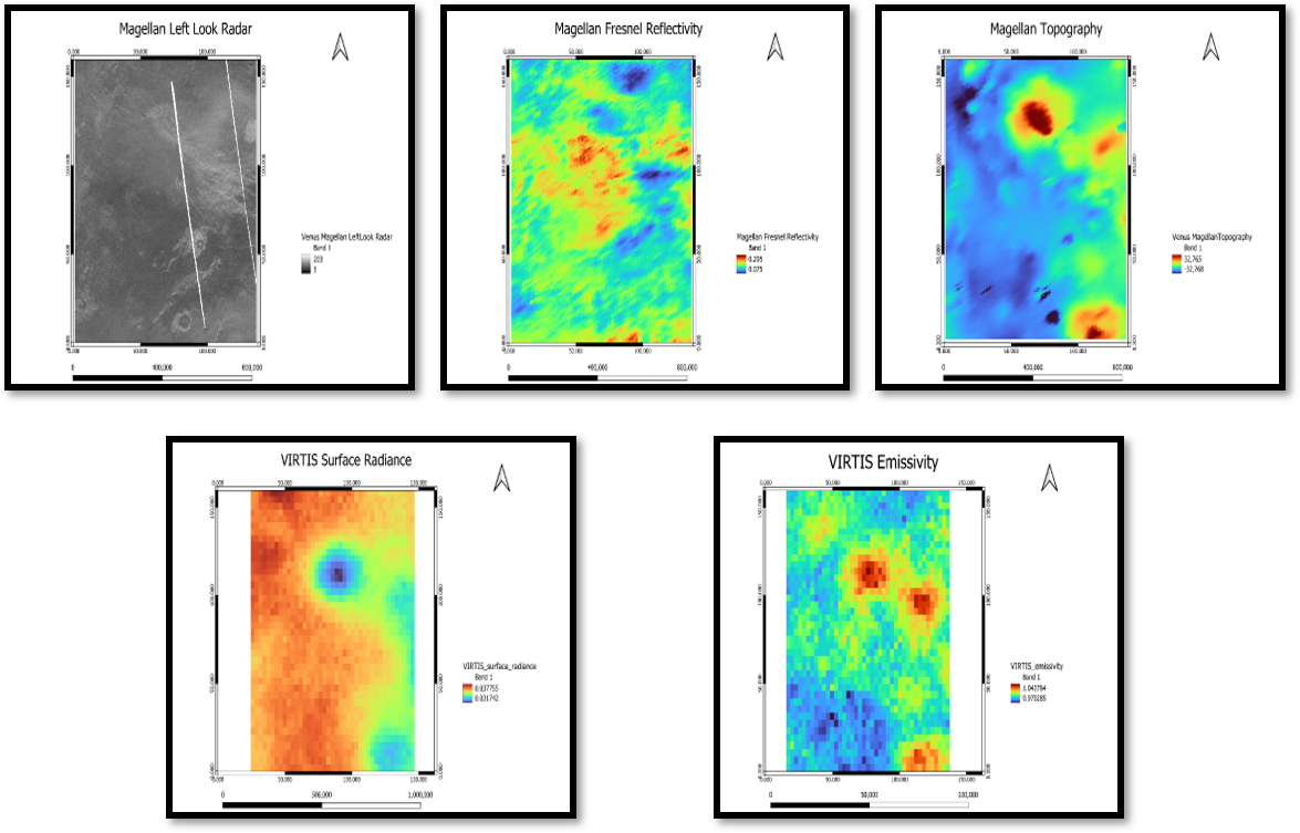 This study investigates the geological characteristics of the transition area between Themis Regio and Helen Planitia on Venus, leveraging a multi-layered dataset comprising Magellan Radar data, Magellan Fresnel Reflectivity, Magellan Topography, VIRTIS Surface Radiance and VIRTIS Emissivity. The selection of this region aligns with the standardized area utilized in the tutorials presented at the GMAP Winter School 2024, facilitating comparative analysis with established geological mapping methodologies. The data layers are meticulously stacked and subjected to comprehensive preprocessing procedures to ensure consistency and mitigate inherent challenges associated with Venusian remote sensing datasets, including atmospheric interference and topographical variations. Subsequently, unsupervised clustering techniques are employed to delineate meaningful spatial patterns within the dataset stack. In this investigation, we explore two widely recognized unsupervised clustering methodologies: K-means clustering and Self-Organizing Maps (SOM).
Notably, our analysis reveals that the SOM yields a less cluttered cluster map than the k-means algorithm within the Venusian dataset and appears to capture intricate geological features. Furthermore, the SOM yields a geologically reasonable scene segmentation also without the application of dimensionality reduction techniques such as Principal Component Analysis (PCA), suggesting its robustness in handling high-dimensional datasets inherent to planetary remote sensing. Moreover, beyond traditional clustering methodologies, our research is planned to extend towards supervised learning approaches utilizing the outputs of unsupervised clustering for automated feature identification. This hybrid methodology harnesses the strengths of both unsupervised and supervised learning paradigms, offering a comprehensive framework for geological mapping and feature characterization on planetary surfaces. The findings of this study contribute to advancing our understanding of Venusian geology and refining remote sensing methodologies tailored for planetary exploration. The insights garnered from this research are instrumental not only in unraveling the geological complexities of Venus but also in informing future missions and exploration endeavors aimed at unraveling the mysteries of our neighboring planet.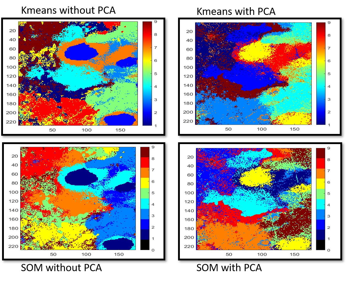
How to cite: Garg, S. and Woehler, C.: A Case Study of Classification Comparison of Venusian Data Layers for Geological Mapping, Europlanet Science Congress 2024, Berlin, Germany, 8–13 Sep 2024, EPSC2024-827, https://doi.org/10.5194/epsc2024-827, 2024.