
 2,2,1,
- 1Department of Pure and Applied Sciences - University "Carlo Bo", Urbino, Italy (agnese.caramanico@campus.uniurb.it)
- 2Centro de Astrobiologia (CAB), Madrid, Spain
Landslides are common features on the surface of Mars, but the debate regarding their dynamics and the role of water (liquid or frozen) is still ongoing. The low percentage of well characterized landslides on Mars (especially from the mechanical point of view) contributes to the general lack of useful data to solve the issue. Our study provides new data of a ~ 7 km long landslide found in an unnamed impact crater on Noachian highlands (Fig. 1), with the aim to unravel its rheology and mechanical properties. Numerical modeling approach, based on Chen and Ling (1996) and Chen and Lee (1999), was combined with geomorphological observations performed at CTX (Context Camera) resolution (~ 6 m/px), useful to select the best rheological model to reproduce the characteristic long runout and the lobate shape of the deposits. The reconstruction of pre-event and basal topographies, performed using HRSC (High Resolution Stereo Camera) derived DEM (Digital Elevation Model, up to 10m/px of vertical accuracy), was based on the estimate of the total volume of the landslide (< 1010 m3) and local morphology. To confirm the results of our custom landslide model, we used the commercial software MADflow to model the landslide and compare the best-fit simulations. Crater counting technique was also applied to estimate the age of the landslide and constrain its rheological properties (and the environmental conditions at the time of occurrence) to Mars history.
We found that simulations with a purely frictional model fail to reproduce the observed morphologies of the landslide while the cohesive-frictional, Coulomb-viscous-type rheology produced the best-fit results (Fig. 2). The geological context showed traces of water activity (mineralogy, valley networks, possible “RSL”) in the surroundings of our case study. All these elements highlight the possibility that water may have been involved in the mass wasting phenomenon.
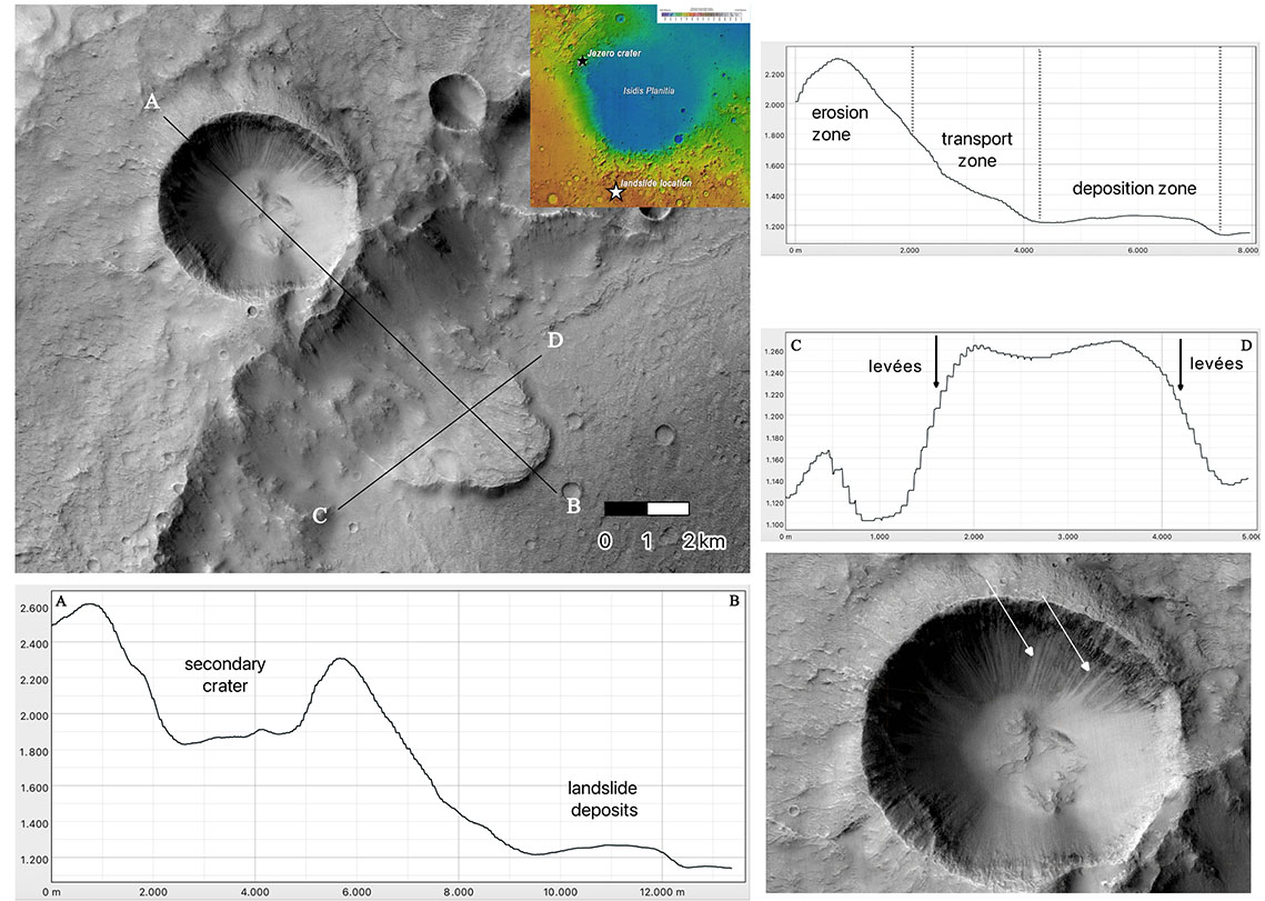
Fig. 1 : location and altimetric profiles (longitudinal, transversal) of the landslide in the unnamed impact crater; in the bottom right corner, close-up view of some lineations on the wall of a fresh crater on top of the rim of the main one hosting the landslide.
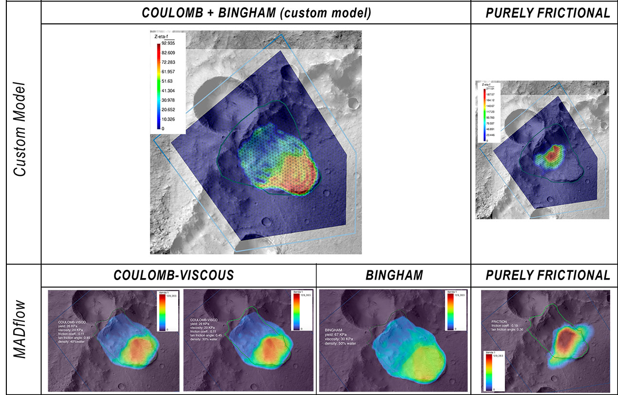
Fig. 2 : summary of simulation results obtained with our custom model and MADflow
How to cite: Caramanico, A., Lanci, L., Herreros, M. I., Molina, A., Francioni, M., and Stocchi, P.: Numerical modeling as a way to assess the mobility and water content in Martian landslides, Europlanet Science Congress 2026, The Hague, The Netherlands, 7–11 Sep 2026, EPSC2026-503, https://doi.org/10.5194/epsc2026-503, 2026.


