Displays

TS7.8

In the past years, there have been major breakthroughs in the understanding of the evolution of Pyrenean orogenic belt and related basins, incorporating new concepts of rifted margins and hyperextension. This is leading to a new generation of lithospheric-scale models addressing the role of tectonic inheritance and the application of the Wilson cycle. Models are being populated with rich new databases on structural geology, paleothermal analysis, low-temperature geochronology and detrital geochronology, mainly applied to the provenance and sediment routing signature of preorogenic and synorogenic basins, all supported by recent collaborative programs like Orogen and other French, Spanish and international projects. We invite contributions that address these points, from diverse and multidisciplinary perspectives.

Share:
Convener: Antonio Teixell | Co-convener: Raphael Pik
Displays
| Attendance Wed, 06 May, 14:00–15:45 (CEST)

Files for download

Session materials Download all presentations (50MB)

Chat time: Wednesday, 6 May 2020, 14:00–15:45

Chairperson: Antonio Teixell, Raphael Pik
D1292 |
EGU2020-20105
| solicited
Emmanuel Masini, Sylvain Calassou, Isabelle Thinon, Olivier Vidal, Gianreto Manatschal, Sébastien Chevrot, Mary Ford, Laurent Jolivet, Frédéric Mouthereau, The Orogen Project team, Julie Tugend, Júlia Gómez-Romeu, and Maxime Ducoux

The Orogen project is a 5-years geosciences research program resulting from an alliance between the CNRS, the French geological survey (BRGM) and Total R&D. Focusing on the Africa-Europe diffuse plate boundary across Iberia, « Orogen » aims at to better understand orogenic processes and its driving mechanisms. One advantage of the project’s playground is that all of the orogenic maturity stages are today exposed from the incipient subduction of the Bay of Biscay to the post orogenic back-arc extension of the Gulf of Lion. One of the significant outcomes of the project is to reveal the fundamental control of the divergent setting on orogenesis through space and time. Through the reconstructed evolution of the Pyrenees, two main types of structural controls can be documented: 1) the crustal template and the spatial partitioning of rifts. Orogenesis starts by a pre-collision stage that consists in the subduction/underthrusting of an inherited divergent « consumable ». It corresponds to the domains located ahead of crustal necking zones (i.e. hyperextended rifts). An exception to the subduction fate of the « consumable » results from the 3D segmentation of rifts. At this stage, shortening needs to spatially linkup different rift axes by shortcutting relay zone.  It results in by back stepping the “subduction” from one branch of rift to the other. It leads to anomalously sample pieces of the « consumable » on the upper plate of the subduction (e.g. Mauléon hyperextended rift in the Western Pyrenees). Once convergence consumes its « consumable », mature collision occurs when crustal necking zones interact with the "subduction" fault plane. Indeed, underthrusting more buoyant thicker crust requires an increase of tectonic stress. At the plate boundary scale, it forces convergence to reorganize spatially and implies the inversion of neighboring less mature branches of rifts by far field stress transmission rather than rupturing unstretched continental domains. When reaching a critical level of stress, crustal indentation starts and thick-skin nappe-stacking propagates beyond necking zones into thick crustal domains. Crustal thickening accelerates launching foreland basin dynamics while orogenic reliefs increase. The orogenic system tends to reach a new equilibrium between tectonic and body forces, accommodated strain, sustaining reliefs and their surface processes counterpart. Then, two end-member cases of post-orogenic dynamic can be defined. Starting right after early orogeny and forced by lateral mature collision, an orogenic system can enter in a "forced" back-arc dynamic (e.g. Gulf of Lion). To achieve this it requires a mature subduction (i.e. enough for a slab-pull) and a remaining "consumable" to subduct (oceanic domain/hyper-thinned crust). The other post-orogenic path following a collision, may be caused by the decrease of tectonic forces relative to body forces. This breaks the depth-surface equilibrium inherited from collision and lead to post-orogenic extension/collapse.

How to cite: Masini, E., Calassou, S., Thinon, I., Vidal, O., Manatschal, G., Chevrot, S., Ford, M., Jolivet, L., Mouthereau, F., Orogen Project team, T., Tugend, J., Gómez-Romeu, J., and Ducoux, M.: The Pyrenees within the Iberian plate boundary: How much an orogenic lifecycle can be influenced by rift structural inheritances?, EGU General Assembly 2020, Online, 4–8 May 2020, EGU2020-20105, https://doi.org/10.5194/egusphere-egu2020-20105, 2020.

D1293 |
EGU2020-20094
Maxime Ducoux, Laurent Jolivet, Romain Augier, Emmanuel Masini, and Sylvain Calassou

The thermal architecture of late rifting to breakup along the deep passive margins is still poorly known. This is mostly because of the limited access to industry drillhole data that, anyway, calibrate topographic highs and rarely the deepest rift domains (and even less the basement). However, unravelling this evolution is a fundamental requirement to define the ultimate exploration potential of these frontier domains. An alternative way to document this thermal evolution is to describe fossil analogues onshore. In this study, we use the fossil hyperextension record of the Pyrenean belt that was sampled by orogenic deformation into the North Pyrenean None and Nappe des Marbres alpine units. Previous studies have shown that the rift came into hyperextension and recorded locally mantle exhumation. These rift domains are associated with a HT-LP metamorphism event that was shown to vary spatially within the rift basin as well as into the basement. In order to restore the late rift thermal architecture of the Pyrenean hyperextended rift, we use a new compilation of Raman Spectroscopy measurements on Carbonaceous Material (RSCM) and Vitrinite Reflectance data. This method allows to record the palaeo-maximum temperatures in the sedimentary basins spatially as well as vertically and can be superposed to geological sections. This method was applied in almost 200 samples collected all along the belt at different stratigraphic level as well as into the Paleozoic basement. When the base of the rift basin is exposed, RSCM Tmax range between 450 and 620°C below a <5km thick sedimentary pile. Western Pyrenees was shown to be an exception as RSCM Tmax are less than 300°C on the outcropping superficial part of the rift basin. However; Vitrinite Reflectance data from wells that are calibrating the deep basin demonstrate that the same thermal intensity was actually reached. These results discard any lateral variation in thermal regime and is pointing out that it is a burial function into a (very)high late rift thermal gradient that largely exceed 100°c/km. Far from being restricted to the Pyrenean case, such a thermal evolution with the same amplitude gradient within the same exhumed mantle domains were documented in the Northern Red Sea example.

How to cite: Ducoux, M., Jolivet, L., Augier, R., Masini, E., and Calassou, S.: Thermal record of hyperextended rifted margins: the fossil record of the Pyrenees, EGU General Assembly 2020, Online, 4–8 May 2020, EGU2020-20094, https://doi.org/10.5194/egusphere-egu2020-20094, 2020.

D1294 |
EGU2020-22005
Nicolas Saspiturry, Abdeltif Lahfid, Thierry Baudin, Laurent Guillou-Frottier, Philippe Razin, Benoit Issautier, Benjamin Le Bayon, Olivier Serrano, Yves Lagabrielle, and Benjamin Corre

Examples of fossil and present-day passive margins resulting from mantle exhumation at the ocean–continent transition appear to have developed under conditions of high mantle heat flow. The pattern of geothermal gradients along these hyperextended margins at the time of rifting is of interest for exploration of geothermal and petroleum resources, but is difficult to access. The fossil rift in the North Pyrenean Zone, which underwent high temperature–low pressure metamorphism and alkaline magmatism during Early Cretaceous hyperextension, was studied to explore the geothermal regime at the time of rifting. Data from a set of 155 samples from densely spaced outcrops and boreholes, analyzed using Raman spectroscopy of carbonaceous material, shed light on the distribution of geothermal gradients across the inverted hyperextended Mauléon rift basin during Albian and Cenomanian time, its period of active extension. The estimated paleogeothermal gradient is strongly related to the structural position along the Albian-Cenomanian rift, increasing along a proximal-distal margin transect from ~34°C/km in the European proximal margin to ~37–47°C/km in the two necking zones and 57–60°C/km in the hyperextended domain. This pattern of the paleogeothermal gradient induced a complex competition between brittle and ductile deformation during crustal extension. A numerical modeling approach reproducing the thermal evolution of the North Pyrenees since 120 Ma suggests that mantle heat flow values may have peaked up to 100 mW.m-2 during the rifting event. We demonstrate that the style of reactivation during subsequent convergence influences the thermal structure of the inverted rift system.

How to cite: Saspiturry, N., Lahfid, A., Baudin, T., Guillou-Frottier, L., Razin, P., Issautier, B., Le Bayon, B., Serrano, O., Lagabrielle, Y., and Corre, B.: Paleogeothermal Gradients across an Inverted Hyperextended Rift System (Mauléon Fossil Rift,Western Pyrenees), EGU General Assembly 2020, Online, 4–8 May 2020, EGU2020-22005, https://doi.org/10.5194/egusphere-egu2020-22005, 2020.

D1295 |
EGU2020-3964
Patricia Cadenas, Gianreto Manatschal, and Gabriela Fernández-Viejo

In this work, we address the problem of the formation and reactivation of multi-stage rifting based on the study of the central North Iberian margin, located at the southern Bay of Biscay triangular oceanic domain. This magma-poor rifted margin registered three major Mesozoic rift events and a subsequent Alpine compressional reactivation, representing a unique setting to study the architecture of a multi-stage rift system and its control on subsequent reactivation. Based on a dense dataset of high quality 2D seismic reflection profiles, boreholes and published velocity models, we define, describe and map structural domains, major extensional and compressional structures, and the depth and thickness of syn-rift units. We provide new structural maps showing the geometry and spatial distribution of major rift basins and bounding structures.

The analysis of the tectono-stratigraphic architecture led us to define three rift systems. A diffuse and widespread of Triassic age, with classical fault-bounded half-graben basins, a second, narrow, deep and localised Late Jurassic to Barremian transtensional system, and a third, widely distributed Aptian to Cenomanian hyperextended system, including two distinctive domains. Our results show that each rift system controlled successive rift events, and that the stacking and overlap of the three rift systems resulted in a complex and segmented 3D template that guided subsequent compressional reactivation. Compression affected on a distinctive way the three rift systems, leading to an amplification of the margin segmentation.

This work shows that unravelling the tectono-stratigraphic architecture and evolution of multi-stage rift systems can provide key insights not only to decipher the spatial and temporal evolution of divergent plate boundaries, but also to set up present-day kinematic templates to test dynamic plate deformable models of conjugate rifted margins. It will also be a keystone to constrain early stages of margin reactivation and the architecture of reactivated rifted margins now incorporated in orogenic systems.

How to cite: Cadenas, P., Manatschal, G., and Fernández-Viejo, G.: The architecture and the multi-stage evolution of the North Iberian margin (Bay of Biscay), EGU General Assembly 2020, Online, 4–8 May 2020, EGU2020-3964, https://doi.org/10.5194/egusphere-egu2020-3964, 2020.

D1296 |
EGU2020-9230
Jordi Miro Padrisa, Patricia Cadenas, Rodolphe Lescoutre, Josep Anton Muñoz, and Gianreto Manatschal

The Basque – Cantabrian Basin (BCB) corresponds to a Mesozoic hyperextended rift basin that was subsequently reactivated from Late Cretaceous to Cenozoic and is at present part of the Pyrenean orogen. Numerous studies have addressed the role of rift inheritance on the formation of orogens, but little consideration has been given to the rift segmentation and the along strike variability. In the BCB, most studies focused on a section at the central part of the basin, despite the amount of geological and geophysical data available on the entire area, which make it a perfect natural laboratory to study the reactivation of a hyperextended basin.

The aim of this study is threefold: (I) reveal the 3D geometry and the along strike variability of the BCB by doing three N-S transversal cross sections from east to west; (II) define the rift domains and their limits; and (III) study the impact of rift inheritance during the compressional reactivation mainly focusing on the former distal rift domains.

Our preliminary results show that the BCB is affected by a multistage and polyphase rift evolution including a first, widespread Permo – Triassic rift phase including Late Triassic salt, a Late Jurassic to Barremian extensional phase and a more prominent Aptian to Middle Cenomanian hyperextension phase.  This complex rift template had a major impact on the subsequent reactivation and can explain some of the along strike variabilities observed within the three regional cross sections. To the east, the BCB was completely reactivated and transported to the south over the Late Triassic salt, which acted as a decoupling level. On the contrary, the westernmost section preserves the rift-related structures only weakly reactivated, providing direct insights on the early stages of reactivation. Our observations show that underthrusting/subduction initiates within the exhumed mantle domain, while during initial collision, the necking domains acted as a buttress. Decollement levels during early stages are located in the former rift distal domains and use serpentinized mantle rocks, while during collision they migrate to more external parts and use intra-basement decoupling levels such as the ductile middle crust and/or salt horizons.

Key words: Rift inheritance, Pyrenees, Basque – Cantabrian Basin, hyperextension.

How to cite: Miro Padrisa, J., Cadenas, P., Lescoutre, R., Muñoz, J. A., and Manatschal, G.: The Basque-Cantabrian Basin: a natural laboratory to study the reactivation of a hyperextended system, EGU General Assembly 2020, Online, 4–8 May 2020, EGU2020-9230, https://doi.org/10.5194/egusphere-egu2020-9230, 2020.

D1297 |
EGU2020-13772
Gabriela Fernández-Viejo, Patricia Cadenas, Jorge Acevedo, and Sergio Llana-Funez

Crustal roots are a consequence of the contraction of continental masses during orogenesis identified in collisional chains worldwide. Frequently mirroring the summits of mountain systems, they portray the fundamental topic of isostasy. The northern Iberian Peninsula presents a rugged topography resulting of the collision with the European plate and the partial closure of the Bay of Biscay during the Cenozoic. Three differentiated systems formed along, from east to west:  a continental collisional chain, the Pyrenees, occupying the isthmus between Iberia and Europe; facing the Bay of Biscay, a deep Mesozoic basin inverted during contraction, the Basque-Cantabrian region, and in the west a crustal pop-up of Palaeozoic basement, the Cantabrian Mountains. The last two extend underwater in the form of a shortened platform, and an accretionary wedge fossilized by post orogenic sediments. The identification of a crustal root beneath the Pyrenees in the 80´s and the observation of a similar morphology beneath the Cantabrian range in the 90´s gave place to the interpretation of the thickening as a continuous feature of the Iberian crust. 
However, a reappraisal of vintage refraction profiles and new data from autocorrelations of ambient noise recordings, challenge the alleged continuity. The Pyrenean-Cantabrian orogeny is a three-plate interaction. Beyond the three types of convergent boundaries we may need to introduce the hyperextended-continent destructive boundary, where this is a well-studied example but not the only one. 

How to cite: Fernández-Viejo, G., Cadenas, P., Acevedo, J., and Llana-Funez, S.: Assessment of the continuity of the orogenic root beneath the Cantabrian-Pyrenean orogen, EGU General Assembly 2020, Online, 4–8 May 2020, EGU2020-13772, https://doi.org/10.5194/egusphere-egu2020-13772, 2020.

D1298 |
EGU2020-7183
Ruth Soto, Pilar Clariana, Conxi Ayala, Antonio M. Casas-Sainz, Teresa Román-Berdiel, Aina Margalef, Belén Oliva-Urcia, Emilio L. Pueyo, Elisabet Beamud, Carmen Rey-Moral, and Félix Rubio

Cenozoic contractional deformation in the Central Pyrenees generated several basement thrust sheets involving Paleozoic rocks and decoupled Mesozoic and Cenozoic cover units detached on the main décollement level, the Triassic evaporites. The overall geometry and structural architecture of the chain have already been established based on numerous geological and geophysical data obtained during several decades. This work aims to validate the overall accepted geometry of the Central part of the chain by the construction of six serial cross-sections constrained by gravity data and 2.5D gravity modelling. The study area comprises the southern half of the Axial Zone between La Maladeta and Andorra-Mont Louis granites and its southern leading edge as well as the northernmost part of the South-Pyrenean Zone.

New gravity data were acquired and combined with previous existing databases to obtain Bouguer anomaly and residual anomaly maps of the study area. Six serial gravity-constrained cross sections have been built using available geological maps, previous published works, new geological and gravity data and 2.5D gravity modelling. Density values for gravity modelling were derived from 231 laboratory measurements of rock samples collected in the field from non-weathered outcrops that include all rock types outcropping in the study area. The residual anomaly map shows a good correlation between basement thrust sheets and gravity highs whereas negative anomalies seem to correspond to (1) Mesozoic basins, (2) Triassic evaporites and (3) Late Variscan igneous bodies. The 2.5D gravity modelling along the six cross sections highlights: (i) strong along-strike variations on the gravity signal due to lateral differences of the surficial and subsurface occurrence of Triassic evaporites, (ii) different geometry at depth of the Late Variscan igneous bodies outcropping in the study area and (iii) geometric lateral variations of the basement thrust sheets and their relationship with the Mesozoic-Cenozoic units.

How to cite: Soto, R., Clariana, P., Ayala, C., Casas-Sainz, A. M., Román-Berdiel, T., Margalef, A., Oliva-Urcia, B., Pueyo, E. L., Beamud, E., Rey-Moral, C., and Rubio, F.: Serial gravity-constrained cross-sections in the Central Pyrenees validating its structural style, EGU General Assembly 2020, Online, 4–8 May 2020, EGU2020-7183, https://doi.org/10.5194/egusphere-egu2020-7183, 2020.

D1299 |
EGU2020-19420
Jorge Acevedo, Gabriela Fernández-Viejo, Sergio Llana-Fúnez, Carlos López-Fernández, Luis Pando, Diego Pérez-Millán, Jordi Díaz, and Mario Ruiz

The Cantabrian Mountains (NW Spain) are an Alpine chain that was formed as a result of the collision between Iberia and Europe in the Cenozoic. In their central sector, the uplift of the orogen led to the exhumation of a block of Variscan -Paleozoic- basement, the reactivation of Variscan structures and the formation of new E-W oriented fractures. Moreover, the formation of the Cantabrian Mountains involved the development of a crustal root with a thickness of 45-55 km that decreases up to 30-35 km towards the west. The thickening occurs preferentially in the crust that had previously been extended during the two main rifting episodes that affected this area in the Mesozoic. At the surface, the limit between the normal and the thickened crust roughly coincides with the trace of the Ventaniella fault, a subvertical crustal structure that runs for more than 400 km both inland and offshore.

In order to obtain new insights from this complex region, it was installed a network (GEOCANTÁBRICA-COSTA, doi:10.7914/SN/YR_2019) of 13 broadband stations covering an area of 160x80 km (~40 km spacing) for 8 months. The phase cross-correlation (PCC) processing technique was used to cross-correlate daily records of the 78 station pairs. After stacking the cross-correlograms, the empirical Green’s functions and the dispersion curves were obtained. Finally, a Rayleigh wave group velocity tomography was performed, retrieving the seismic signature of the Variscan crust and allowing us to extend to the north our previous seismic ambient noise tomography and complete the tomographic model of the central Cantabrian Mountains. To reveal the structure beneath the seismic stations, we also performed ambient noise auto-correlations, successfully retrieving body-wave reflections from the crust-mantle boundary that provide new information about the limits of the crustal root.

The study area presents a lingering, low-magnitude intraplate seismic activity that increases from east to west and extends into the continental shelf. The Ventaniella fault also acts as a seismic barrier to the propagation of earthquakes towards the east while provides nucleation sites along its trace. Thus, another objective of this study was to detect and relocate the local seismicity of the Cantabrian Mountains and the Cantabrian margin activity in particular. Our preliminary catalogue of events, obtained from the automatic analysis of the real-time seismic data with SeiscompP3, comprises 54 local earthquakes. Seven of them have their epicentres in the Cantabrian margin and, as expected, all were located to the west of the Ventaniella fault.

How to cite: Acevedo, J., Fernández-Viejo, G., Llana-Fúnez, S., López-Fernández, C., Pando, L., Pérez-Millán, D., Díaz, J., and Ruiz, M.: Ambient noise tomography of the Central Cantabrian Mountains (NW Spain). New insights from the GEOCANTABRICA-COSTA seismic network., EGU General Assembly 2020, Online, 4–8 May 2020, EGU2020-19420, https://doi.org/10.5194/egusphere-egu2020-19420, 2020.

D1300 |
EGU2020-5688
Conxi Ayala, Pilar Clariana, Ruth Soto, Joan Martí, Aina Margalef, Emilio Pueyo, Félix Rubio, Carmen Rey-Moral, Nuria Bach, Stefania Schamuells, and Jordi Cirés

In the Central Pyrenees, where density contrast between the Paleozoic rocks and the intruded granitic bodies is measurable, geological cross-sections constrained with gravity data help to unravel the subsurface geometry of the granites.

With this goal in mind, during 2018 and 2019 several gravimetric surveys were carried out in the Central Pyrenees to improve the existent spatial resolution of the gravity data from the databases of the Spanish and Catalan Geological Surveys, especially in La Maladeta and Andorra Mont-Louis granites’ area. After the gravity reductions, we obtained the Bouguer gravity anomaly from which we calculated the residual gravity anomaly by subtracting a third degree polynomial which represents the regional anomaly in agreement with the geometry of the crust in this region.

The gravimetric response over La Maladeta and Andorra Mont-Louis granites is markedly dissimilar pointing out differences in the composition and geometry at depth of the two granites. La Maladeta granite shows a gravimetric zonation with small variations in its amplitude from one zone to the next, consistent with small lateral changes in its composition, predominantly granodioritic. By contrast, the Andorra Mont-Louis pluton is characterized by a relative minimum suggesting a more granitic composition.

With respect to the inferred geometry at depth, the results obtained from gravity modelling show that the La Maladeta granite displays a laccolithic shape with its basal contact deeping to the North whereas the Andorra Mont-Louis granite has a more batholitic shape. Although the emplacement age of both granites is similar (Late Carboniferous – Early Permian), their different geometry at depth suggests that either (1) their emplacement mechanisms were different or (2) the subsequent Alpine orogeny affected both granites in different ways better preserving the original geometry of the Andorra Mont-Louis granite.

How to cite: Ayala, C., Clariana, P., Soto, R., Martí, J., Margalef, A., Pueyo, E., Rubio, F., Rey-Moral, C., Bach, N., Schamuells, S., and Cirés, J.: Constraining the geometry at depth of La Maladeta and Andorra-Mont Louis granites (Central Pyrenees) through gravity modelling, EGU General Assembly 2020, Online, 4–8 May 2020, EGU2020-5688, https://doi.org/10.5194/egusphere-egu2020-5688, 2020.

D1301 |
EGU2020-13505
Marc Guardia, Albert Griera, Boris Kaus, Andrea Piccolo, and Antonio Teixelll

Tectonic nappes are typical structural features in orogenic belts worldwide and include two end members, namely thrust nappes and fold nappes. Although the geometry and kinematics of these are relatively well constrained after more than a century of studies, the mechanics are still incompletely understood.

In recent years, numerical modelling has become a powerful tool to unravel the mechanics of fold nappes. Studies have been carried out particularly with application to the Helvetic nappes of the Alps, highlighting the relevance of the mechanical stratigraphy involved in the deformation. The Helvetic nappes consist of a superposition of thrust nappes over recumbent fold nappes. It was developed due to the closure of half-graben basins and the extrusion of their sedimentary infill under dominantly ductile deformation conditions. Competence contrast between stiff (i.e. limestones) and weak layers (i.e. shales) played a key role in controlling the deformation style.

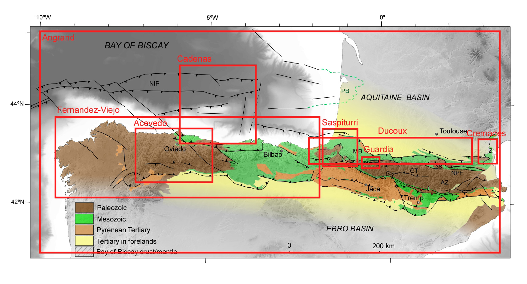
Recently, a similar structure has been reported in the Pyrenees. The Eaux-Chaudes massif (western Axial Zone, Pyrenees) is a basement-cored recumbent anticline with a kilometric, long reverse limb showing ductile deformation in Mesozoic carbonates, much in style of the Helvetic nappes of the Alps. The reverse limb is in thrust contact over an autochthonous Mesozoic cover with similar stratigraphy, and hence its development cannot be explained by basin infill extrusion. The fold structure shows a strain increase towards the reverse limb and is overlain by the Lakora basement thrust sheet. The general stratigraphic succession consists of Upper Cretaceous limestones and shales lying unconformably over Paleozoic metasediments or Lower Triassic sandstone pods and featuring inliers of Upper Triassic Keuper facies and ophites. The autochthonous succession lies on top of a late Variscan granitic pluton, both showing very low-strain during Alpine deformation.

Here, we employ the thermomechanical staggered finite difference code LaMEM (Kaus et al., 2016) to perform 2D parametric simulations in order to study changes in deformation style between thrust nappes (plastic/brittle-localisation) and recumbent fold nappes (viscous/ductile-distributed). The simulations are performed using a linear viscoelastoplastic rheology with the Drucker-Prager criterion for plasticity. The initial setup consists of two domains separated by a basement perturbation and both overlain by a lower stiff layer, representing the Upper cretaceous limestones. In the right-bottom half domain there is a stiff body representing the Eaux-Chaudes pluton, while in the bottom-left domain there are weak layers representing the shale-rich Paleozoic basement. Over the stiff layer, there is a multilayer of weak and stiff layers mimicking the Lakora thrust sheet, which provides the overburden and confining pressure.

Preliminary results show a strong control of the cohesion and viscosity of the lower stiff layer on the deformation style developed. For simulations with low cohesion values, there is an enhancing of strain localization and thrust nappe development is favoured, whereas high cohesion values tend to spatially distribute the deformation and facilitate the development of fold nappes. Further simulations are in progress to test these preliminary results.


Kaus, B., Popov, A., Baumann, T.S., Püsök, A.E., Bauville, A., Fernandez, N and Collignon, M. (2016): In: NIC Symposium, Proceedings, 48.

How to cite: Guardia, M., Griera, A., Kaus, B., Piccolo, A., and Teixelll, A.: Mechanical controls on recumbent folding from 2D numerical simulations. Applications to the Eaux-Chaudes fold nappe (west-central Pyrenees), EGU General Assembly 2020, Online, 4–8 May 2020, EGU2020-13505, https://doi.org/10.5194/egusphere-egu2020-13505, 2020.

D1302 |
EGU2020-6716
Antoine Crémades, Mary Ford, and Julien Charreau

Tectono-stratigraphic evidence of salt tectonics during Jurassic extension in the Corbières nappe, Eastern Pyrenees, France

 Antoine Crémades1, Mary Ford1 et Julien Charreau1

1 CRPG, UMR 7358 CNRS, Université de Lorraine, Vandoeuvre‐lès‐Nancy, France


In this work, we investigate the tectono-stratigraphic architecture of a major transfer zone in the Mesozoic Pyrenean rift system and its subsequent alpine inversion. The NE-SW to NS-oriented Corbières transfert zone (70km long) lies between the EW-oriented Pyrenean (400km long) and Provençal (300km long) segments of the Pyrenean orogen. This salt-rich rift transfert zone was inverted during the Pyrenean orogenesis (late Santonian - Early Miocene). During the Oligo-Miocene, most of the transfert zone was further reactivated to form the northern margin of the Gulf of  Lion rift. Thus, only the lateral equivalent of the North Pyrenean Zone outcrops along the western French Mediterranean coast. Unlike the the North Pyrenean Zone, which is a narrow fold and thrust belt, this proximal part of the tranfert zone was previously interpreted as a large thrust sheet (the Corbières Nappe, 70km long) corresponding to Mesozoic cover decoupled from Variscan basement along a thick level of Upper Triassic evaporites (Keuper, 0m to 655m) and emplaced onto the Aquitaine retro-foreland basin during the Priabonian, at the end of Pyrenean orogenesis. 

Our detailed study of the tectono-stratigraphic architecture of the Corbières Nappe demonstrates for the first time the existence of major Jurassic extensional structures linked to strong halokinetic activity. These structures were previously interpreted as compressional and Pyrenean in origin: (1) The Treilles Fault is a N110 trending, shallowly S-SW dipping fault at least 12 km long, which roots on Triassic evaporites. This normal fault with 2.8 km of displacement cuts the Corbières Nappe into two distinct structural units. A 3D hangingwall dip fan associated with stratal thickening toward the fault demonstrates that this extensional fault was active during the full Jurassic and maybe during the early Cretaceous. (2) In the footwall of the Treilles Fault, the Valdria NE-SW trending fold pair was previously interpreted as a Pyrenean compressional fold. Detailed mapping of 3D thickness and geometry variations in the Jurassic series around these folds reveals NW verging syn-sedimentary folding during the Jurassic. We propose that this folding is linked to the growth of the Feuilla Keuper diapir that lies immediately to the south. The highlighting of these complex halokinetic and extensional structures of Early Jurassic to Early Cretaceous age have major implications for (1) the Pyrenean and Tethysian Mesozoic extensional systems in the eastern Pyrenees and (2) their impact as a major regional inheritance in later orogenic phases, in particular in the evolution of the Pyrenean Corbières Nappe.


How to cite: Crémades, A., Ford, M., and Charreau, J.: Tectono-stratigraphic evidence of salt tectonics during Jurassic extension in the Corbières nappe, Eastern Pyrenees, France, EGU General Assembly 2020, Online, 4–8 May 2020, EGU2020-6716, https://doi.org/10.5194/egusphere-egu2020-6716, 2020.

D1303 |
EGU2020-13764
Paul Angrand, Frédéric Mouthereau, Emmanuel Masini, and Riccardo Asti

The West European kinematic evolution results from the opening the West Neo-Tethys and the Atlantic oceans since the Late Paleozoic and the Mesozoic, respectively. Geological evidence suggests that the Iberian domain was strongly overprinted by the propagation of these two rift systems and is therefore key to significantly advance our understanding of the regional plate reconstructions. The Late Permian-Triassic tectonic evolution of Iberian rift basins show that they have accommodated a significant component of extension, which remain however difficult to quantify. This tectonic stage is therefore often neglected in most plate kinematic models, leading to the overestimation of the movements between Iberia and Europe during the subsequent Mesozoic (Early Cretaceous) rift phase.

We compile seismic profiles and geological constraints along the North Atlantic margins and over Iberia, as well as existing kinematic and paleogeographic reconstructions to build a coherent, global kinematics model that consider both the Neo-Tethyan and Atlantic evolutions. We use tectonic subsidence analyses from the literature to quantify the apparent extension during the Late Permian to Early Cretaceous extensive phase. We show that an improved knowledge of the distribution in space and time of the deformation between Europe and the Iberian domain can be obtained for the Late Permian-Mid Cretaceous period. Our model differs from standard models that consider left-lateral strike-slip movement localized in the northern Pyrenees. The Europe-Iberia plate boundary rather forms a domain of distributed and oblique extension made of two rift systems, in the Pyrenees and in the Iberian intra-continental basins. This reconstruction emphasizes the need for an Ebro block and the significant strike-slip movement south of the Ebro block that is however minimized by accounting for the previous Late Permian-Triassic extension. We propose that these two rifts accommodated the same order of magnitude of strike-slip movement during the evolution of the Iberia-Europe (diffuse) plate boundary.

Our reconstructions reveal that the Late Permian-Triassic rift and magmatic evolution of the western Europe, at the western tip of the Neo-Tethyan Ocean, controlled the subsequent localization of the Atlantic rift. Our study provides a significant advance that allows reconciling the main geological observations, including the lack of major strike-slip faulting and a large oceanic basin in northern Iberia. The temporal overlap between Late Variscan magmatism and the Neo-Tethyan extension is not directly addressed in this contribution but its impact on the Earth’s surface evolution and topography during initial rifting certainly requires further investigations.

How to cite: Angrand, P., Mouthereau, F., Masini, E., and Asti, R.: A reconstruction of Iberia accounting for West Tethys/North Atlantic kinematics since the Late Permian-Triassic, EGU General Assembly 2020, Online, 4–8 May 2020, EGU2020-13764, https://doi.org/10.5194/egusphere-egu2020-13764, 2020.