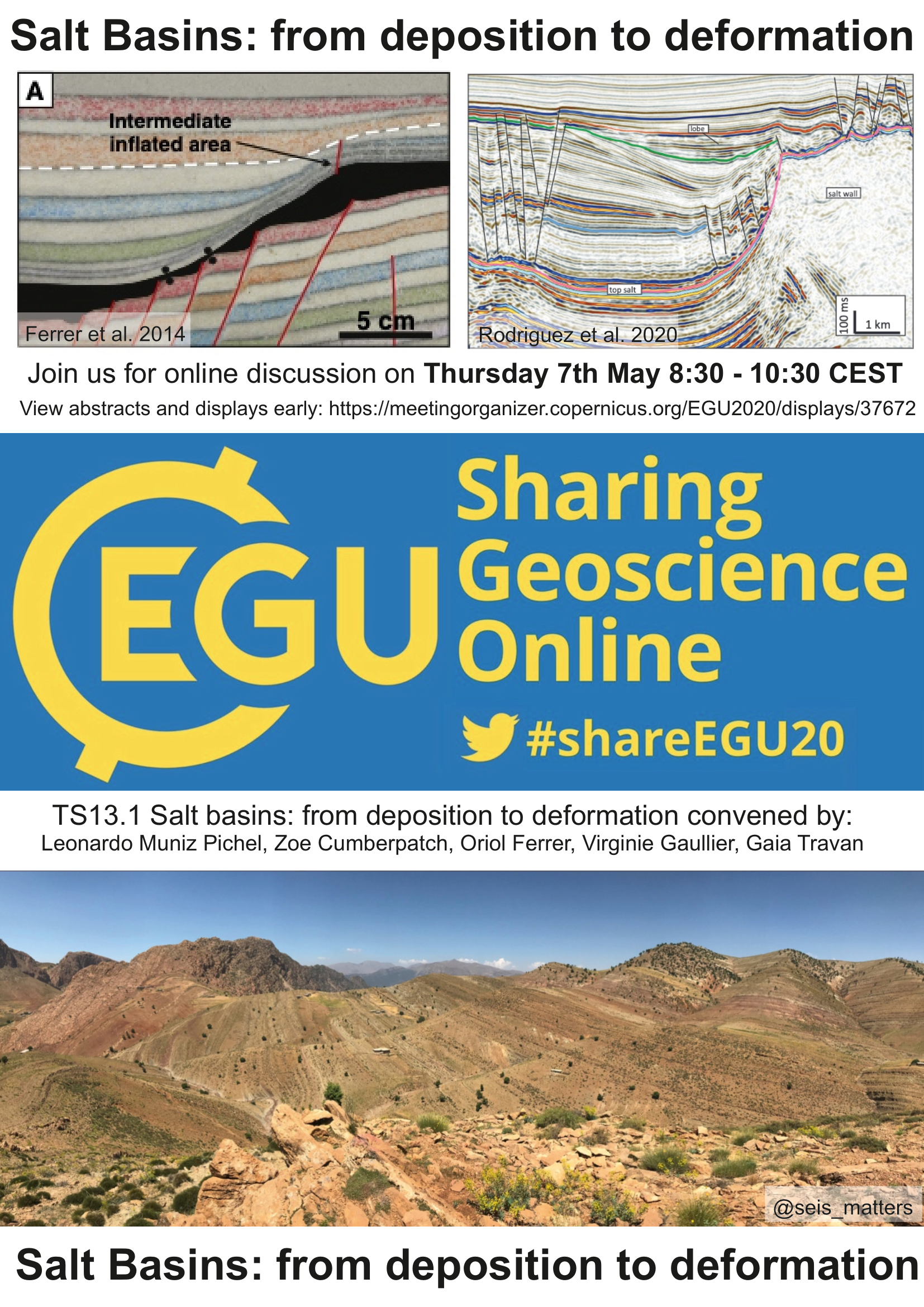
Displays
Salt basins present some of the most spectacular geological structures on Earth. They are remarkably important for mineral and hydrocarbon exploration, comprising the world’s largest and most prolific hydrocarbon provinces, as well as for nuclear waste and CO2 repositories. Due to salt’s unique ability to flow as a viscous fluid over typical geological strain-rates, it produces complex and variable deformational styles within sedimentary basins, which are critical for understanding basin evolution and prospectivity. The uniqueness and inherent complexity associated with salt tectonics make it one of the most interesting and challenging topics in basin studies, usually requiring an integrated multi-discipline approach. Recent advances in seismic imaging and modelling (numerical and physical), coupled with a growing database of outcrop analogues have, nonetheless, allowed the development of novel concepts in salt tectonics and more detailed analyses of its kinematics, dynamics, internal deformation and interaction with sedimentation. This session explores the new challenges and advances in salt basins worldwide, from salt deposition to deformation, to improve the current knowledge of salt tectonics and basin evolution. We invite abstracts from a variety of datasets, locations and geological settings, to cover academic and industrial topics including:
• Subsurface, outcrop and modelling studies of salt basins
• Salt tectonics in extensional, contractional and strike-slip settings
• Salt-bearing passive margins
• Evaporite deposition and the interaction between intra-salt lithological heterogeneities on salt deformation.
• Thin- and thick-skinned salt tectonics
• Advances in seismic imaging, processing and interpretation in salt basins globally
• The interaction between halokinesis and sediment routing, minibasin stratigraphy and implications for subsurface energy exploration potential.
Public information:
• We will discuss displays in the order they appear in the programme, which may be different to that shown down the side of the chat.
• All abstracts listed the the session summary will be discussed, if authors are not present we will move on to the next author
• Depending on amount of authors present we will have between 6-8 minutes to discuss each display
• Authors are asked to prepare a short (1-4 sentence) introduction to themselves and their work, following this question will be taken from the floor.
• Time permitting we can return to previous abstracts/displays at the end or have a more broad discussion on the future of salt tectonics.
• We ask authors to promote their presentations and the session on social media etc. using #ShareEGU20 and #saltsaturday
Files for download
Session materials Session summary Download all presentations (99MB)
Chat time: Thursday, 7 May 2020, 08:30–10:15
In salt-detached gravity-gliding/spreading systems the detachment geometry is a key control on the downslope mobility of the supra-canopy (supra-salt) sequence. As supra-canopy minibasins translate downslope, they also subside into salt. If the base of salt has high relief, minibasins may weld and stop from further free translation downslope. The degree of minibasin obstruction controls both the kinematics of the individual basins, and the more regional pattern of supra-canopy strain. Here, we use regional 3D seismic data to examine a salt-stock canopy in the northern Gulf of Mexico slope, in an area where supra-canopy minibasins subsided vertically and translated downslope above a complex base-of-salt with high relief.
At a regional scale, we distinguish two structural domains in the study area: a highly obstructed or locked domain and a highly mobile domain. Large-scale translation of the supra-canopy sequence is recorded in the mobile domain by two different structures (a far-travelled minibasin and a ramp syncline basin). Although identifying the deformation area between the two regional domains is challenging due to its diffusive nature, characterizing domains according to base-of-salt geometry and supra-canopy minibasin configuration is helpful in identifying structural domains that may share similar subsidence and downslope translation histories.
At minibasin scale, minibasins that become obstructed modify the local strain field, typically developing a zone of shortening immediately updip of it and an extensional breakaway zone immediately downdip. Seismic attribute analysis performed in a cluster of minibasins in the study area illustrates a long-lived sediment transport system affected by the complex strain patterns associated with minibasin obstruction. At an early stage, a submarine channel system is captured and subsequently rerouted in response to the updip shortening associated with minibasin obstruction. At a later stage, a mass-transport complex (MTC) is steered by the topographic barrier created by the downdip extensional breakaway associated with minibasin obstruction.
Our work illustrates how salt-tectonic processes related to minibasin obstruction can affect the canopy dynamics at both regional and minibasin scale. Furthermore, we show that minibasin obstruction processes can modify the seafloor and subsequently control deepwater sediment dispersal, which, ultimately can affect hydrocarbon reservoir distribution on salt-influenced slopes
How to cite: Fernandez, N., Duffy, O., Peel, F., Hudec, M., Apps, G., and Jackson, C.: Minibasin mobility and obstruction on salt-detached slopes: implications for canopy dynamics and sediment routing, EGU General Assembly 2020, Online, 4–8 May 2020, EGU2020-11125, https://doi.org/10.5194/egusphere-egu2020-11125, 2020.
Along the West African margin from Gabon to southern Angola, the Loeme Aptian salt deposited during the late rift break-up process. Following the Atlantic opening, passive margin subsidence, large deltas and dynamic topography triggered and shape gravity tectonic systems. Evaporite deposition occurred during the break-up process, from the rupture of the continental crust to the spreading, thus providing an early inheritance (in term of thickness and geographic distribution of evaporites) for future salt tectonics, which is largely controlled by the genetic domain compartmentalizing the margin, namely the proximal margin, the neck basin, the distal margin, and the outer high and exhumed mantle. Classically, since the mid-90s the gravity gliding system pattern, with the usual triptych extension-translation-compression, has been over-applied along the West African margin. Recent data from Angola show mini-basins in a context of gravity spreading in addition to pure gliding-spreading roll-overs, rafts and diapirs, as well as mini basins developed during the early phase of evolution, and were later on squeezed by the gliding cell. We present here a regional study to compare major internal and external factors controlling halokinesis structural styles and we propose new maps and cross-sections up to 300 km long from onshore to ultra-deep offshore, to describe the main domains and styles across the Gabon, Lower Congo, Kwanza, Benguela and Namibe sub-basins. This work is based on an extensive 2D and 3D seismic reflection data, wells and internal reports. Margin scale cartographic compilation of both pre- and post-salt tectono-sedimentary trends provide elements to constrain both geometries and kinematics. This study documents the spatial and temporal distribution of both the inherited salt controlled basins (i.e. minibasins, salt ridges, etc.) as well as the superimposed gravitational systems, their characteristics and drivers (e.g. gliding, spreading), and by linking them to the genetic domains of the margin to highlight their various roles.
How to cite: Legeay, E., Ringenbach, J.-C., and Callot, J.-P.: Along-Strike Variation of Halokinesis and Structural Inheritance Along the West African Salt Basin, South Atlantic, EGU General Assembly 2020, Online, 4–8 May 2020, EGU2020-12996, https://doi.org/10.5194/egusphere-egu2020-12996, 2020.
The two dimensional geometry and evolution of salt walls driven by differential loading could be considered well established from previous studies. However, little is known about the internal deformation at the flanking edges and the 3D architecture at their terminations. This induces risk in hydrocarbon exploration of poorly imaged areas that could be significantly reduced with a better understanding of near-salt deformation and salt-sediment interaction in three dimensions. Using an experimental approach based on sandbox models and comparing their results with the southeastern termination of the Gypsum Valley salt wall in the Paradox Basin, we investigate both the internal deformation and the 3D structure of rectilinear salt walls emphasizing the development of faults and folds, including megaflaps, around their terminations. The experimental program includes 5 experiments simulating the salt, pre-kinematic overburden and syn-kinematic detrital deposits with a pure polymer, a sand/clay mixture and silica sand, respectively. It includes experiments with different salt/pre-kinematic overburden thickness ratios and salt wall edge geometries.
The experimental results document that in rectilinear salt walls driven by differential loading the plan-view geometry of the salt walls depends (amongst other factors) on the salt thickness. Hence, salt wall terminations developed over a constant-thickness salt layer are abrupt with a rectangular form; and those developed over a progressively decreasing salt layer thickness are gradual with a plan-view triangular shape. They also show that:
- At the salt walls edges, the pre-kinematic overburden is folded by limb rotation in the younger minibasin side and by limb lengthening with vertical shearing in the older minibasin side.
- The prekinematic overburden is internally almost underformed in the younger minibasin side where megaflaps developed. Instead, it is much strongly deformed (faulted) and broken by extensional faults in the opposite older minibasin side. This could have strong implications for hydrocarbon exploration since: 1) the megaflaps lack any significant secondary porosity and have lateral continuity of bedding; and 2) the prekinematic package of the older minibasin is compartmentalized and affected by internal deformation that can significantly increase its porosity and permeability.
- At the ends of the salt walls, faults are mainly parallel or perpendicular to the diapir trend, being predominantly transversal in the abrupt terminations and longitudinal in the gradual ones.
- Radial faults are rare and only present at the corners of abrupt salt wall terminations.
How to cite: Roca, E., Ferrer, O., Rowan, M., Escosa, F., Muñoz, J. A., and Giles, K.: 3D structure and kinematics of salt walls and megaflaps driven by differential loading: lessons from analogue modeling and field examples, EGU General Assembly 2020, Online, 4–8 May 2020, EGU2020-3328, https://doi.org/10.5194/egusphere-egu2020-3328, 2020.
The Barreme Basin and the Gevaudan diapir - an example of the interplay between compressional tectonics and salt diapirism
Adam Csicsek and Rod Graham
Imperial College London
Our understanding of the role of salt diapirism in determining the finite geometry of fold and thrust belts has grown apace in the last few years, but the interplay between the two remains a significant problem for structural interpretation. The Gevaudan diapir in the fold and thrust belt of the sub-Alpine chain of Haute Provence is well known and has been documented by numerous eminent alpine structural geologists. Graciansky, Dardot, Mascle, Gidon and Lickorish and Ford have all described and illustrated the geometry and evolution of the structure, and Lickorish and Ford’s interpretation is figured as an example of diapirism in a compressional setting by Jackson and Hudec in their text on salt tectonics. We review these various interpretations and present another.
The differences between the various interpretations say much about the complex interplay of salt diapirism and thin-skinned thrusting and have profound implications for the way we interpret the tectonic and sedimentary evolution of the Barreme basin which lies adjacent to the diapir
The Barreme basin is a thrust-top fragment of the Provencal foreland basin and has been described in detail from both sedimentological (e.g. Evans and Elliott, 1999) and structural (e.g. Antoni and Meckel, 1997) points of view. Here we make the case that it is also a salt related minibasin - a secondary minibasin developed on a now welded allochthonous Middle Cretaceous salt canopy. We believe that within the basin it is possible to interpret successive depocentres which may record progressive salt withdrawal. We argue that though thrust loading must be the fundamental driving mechanism responsible for salt movement late in the tectonic history of the region, thrusting has not done much more than modify existing salt related geometry.
How to cite: Graham, R. and Csicsek, A.: The Barreme Basin and the Gevaudan diapir - an example of the interplay between compressional tectonics and salt diapirism, EGU General Assembly 2020, Online, 4–8 May 2020, EGU2020-3655, https://doi.org/10.5194/egusphere-egu2020-3655, 2020.
The southern Fars region of Iran is a classical and very well-studied area of salt tectonics for more than a century. Our study area is located in the “Simply Folded Belt” of the Zagros Mountains, including the nearby offshore of the Persian Gulf, and has a large number of well-known salt diapirs. These diapirs, composed of the infra-Cambrian Hormuz evaporites, have a surface diameter between 2-12 km and may extend vertically beneath the surface down to anywhere between 6-12 km.
In outcrop, the most striking aspect of these diapirs is the very large proportion of non-evaporitic rocks embedded within the evaporites. Also, these extraclasts (or megaclasts) are sometimes very large, reaching even the kilometer scale. We interpret their present-day dominance and ubiquitous „crowding“ in the outcropping apex of any given diapir as quite misleading as to their overall compositional contribution to these salt bodies. In our view, their seemingly large proportion in the internal make-up of the diapirs should be attributed to the preferential preservation of non-evaporitic rocks exposed on the surface. We argue that the real proportion of the overall non-evaporitic rocks within a typical Hormuz diapir could be as low as 1-2%, but certainly not more than 10%. Nevertheless, given their typical lithologies composed of crystalline basement, Eocambrian carbonates and sandstones with very high seismic velocities on the order of 5,000-5,500 m/s, the megaclasts may make the „dirty“ salt faster than the typical 4,500 m/s velocity of a typical “clean” rock salt sequence. These distinct crystalline and poorly dated Lower Paleozoic carbonate and clastic rocks found in the diapirs appear to have analogue formations outcropping only very far from the study area, like in Central Iran.
Importantly, as reported by others earlier, we have not found any evidence for the presence of post-Hormuz (i.e. post-Cambrian) host-rock lithologies incorporated into the diapiric material. Therefore, the strikingly selective nature of the extraclast lithologies within the diapiric bodies points to their original intra-Hormuz stratigraphic position. During Cenozoic diapirism, these infra-Cambrian Hormuz “stringers”, also including some pre-rift basement lithologies, were selectively incorporated into the ascending evaporite material as megaclasts and were carried to the surface from large depth. Therefore, one of the important conclusions of our study is that the various Hormuz intra-salt lithologic units must have deposited in a broad, wide-rift extensional setting.
How to cite: Tari, G., Gharabeigli, G., Majidi, A., Lovett, T., Julapour, A. A., Hinsch, R., Sellar, C., and Kosi, W.: How pre- and syn-Hormuz formations were incorporated into the Zagros salt diapirs and reached the surface?, EGU General Assembly 2020, Online, 4–8 May 2020, EGU2020-21499, https://doi.org/10.5194/egusphere-egu2020-21499, 2020.
Many sedimentary basins worldwide host extensive evaporite deposits, which through salt tectonic processes can form a variety of complex salt structures and diapirs. Many of these basins also host extensive networks of igneous intrusions. It thus seems inevitable that, in some scenarios, magma intruded into a sedimentary basin will interact with salt. However, we have a poor understanding of how the unique rheological and compositional properties of salt, or the local stress states developed around salt bodies, may influence the emplacement and composition of magma. For example, do evaporites and associated salt structures provide preferential flow pathways for ascending magma, or do they capture magma? We also do not know how the interaction of hot magma with salt, or the presence of crystallised intrusions within salt, may impact halokinesis. To understand how salt and magma interact, it is critical to investigate both their structural and chemical relationships within a framework where the timing of intrusion, evaporite deposition, and salt movement is well-constrained. Key problems with this ideal approach to unravel salt-magma interaction are: (i) field (or outcrop) exposures of intrusions within salt allow chemical and small-scale structural analysis of magma-salt interactions, but provide little insight into how the whole system behaved in 3D; whilst (ii) seismic reflection images of intrusions within salt bodies reveal their 3D architecture and may provide insight into the impact of magmatism on halokinesis, but do not allow chemical or small-scale structural analysis, unless drilled.
Here, we use 3D seismic reflection data from the Santos Basin, offshore Brazil to characterise the structure of, and relationships between, 38 igneous sills emplaced below, within, or above a Lower Cretaceous evaporite layer. Salt movement initiated soon after deposition, primarily driven by gravity-driven extension, and continued throughout most of the Cenozoic but with different kinematics and degree of salt rise and diapirism throughout the study-area. In the area hosting the sills, Late Cretaceous-Cenozoic deformation was dominated by continued extension with limited salt rise and diapirism. Conversely, in the area where no sills are recognized, Late Cretaceous-Cenozoic salt tectonics was characterized by passive/active diapirism and localized shortening.
There is little overall geometrical difference between sills emplaced below, within, and above the salt, but we note that many intra-salt sills appear more segmented. Seismic-stratigraphic relationships indicate sill emplacement occurred during several episodes in the Cretaceous between the Turonian-to-Santonian. We suggest this phase of magmatism, which separated the major Albian-Cenomanian and Cenozoic periods of salt movement, locally inhibited diapirism and thereby changed the mode of basin deformation. We attribute this local change in salt diapirism to: (i) crystallisation of igneous sills, which locally increased the mechanical strength of salt and overburden, limiting salt rise and acting as buttresses to lateral salt movement; and (ii) melting and assimilation of weak evaporite layers (e.g., carnallite), which usually act to lubricate salt movement, into the magma. These results shed light into the interaction of two common and important structural processes in sedimentary basins that are relatively well studied separately but whose interaction is often overlooked.
How to cite: Magee, C., Muniz-Pichel, L., Madden-Nadeau, A., and Jackson, C.: 3D seismic imaging reveals salt-magma interactions in the Santos Basin, offshore Brazil, EGU General Assembly 2020, Online, 4–8 May 2020, EGU2020-19196, https://doi.org/10.5194/egusphere-egu2020-19196, 2020.
This study uses a combination of 2D and 3D seismic reflection surveys coupled with borehole data from the Irish Atlantic margin to map the distribution of salt in the Slyne and Erris basins and understand its influence on basin development throughout the Mesozoic.
The north-western European Atlantic margin is populated by a framework of rift basins stretching from the Barents Sea offshore northern Norway to the south of Portugal. Several of these basins contain significant quantities of salt, which plays an important role in basin development and structural evolution. While salt is present on the Irish Atlantic margin, its distribution and role in basin development is poorly understood. The Slyne and Erris basins, off the northern coast of Ireland, contain two proven layers of salt; the Upper Permian Zechstein Group and the Upper Triassic Uilleann Halite Member of the Currach Formation.
Where present in their salt-dominated forms, both layers act as décollements, mechanically detaching pre-, intra- and post-salt stratigraphy. The Zechstein Group is present throughout the Slyne and Erris basins, while the Uilleann Halite Member is only developed in the northern Slyne Basin and the southern Erris Basin. Both salt layers have undergone significant halokinesis during basin development, and their original thicknesses are unclear. This halokinesis has played a significant role in the formation of hydrocarbon traps in these basins: the Zechstein Group forms salt pillows and salt rollers, causing folding and rafting in the overlying Mesozoic section, driven by active faulting in the pre-salt Palaeozoic basement. The Uilleann Halite Member caused thin-skinned crestal collapse and delamination of the overlying Jurassic section above anticlines cored by Zechstein salt. Both layers of salt play a key role in the development of the Corrib gas field and are responsible for trap formation in the Corrib North and Bandon discoveries. Understanding the genesis of these salt-related structures in a multi-layered salt system will provide insight into future exploration activities in salt-prone basins offshore Ireland, as well as their suitability for storage of sequestered CO2.
ICRAG is funded in part by a research grant from Science Foundation Ireland (SFI) under Grant Number 13/RC/2092 and is co-funded under the European Regional Development Fund and by PIPCO RSG and its member companies.
How to cite: O'Sullivan, C., Childs, C., Saqab, M., Walsh, J., and Shannon, P.: Influence of a multi-layered salt stratigraphy on rift-basin development; Insights from the Slyne and Erris basins, offshore NW Ireland, EGU General Assembly 2020, Online, 4–8 May 2020, EGU2020-19997, https://doi.org/10.5194/egusphere-egu2020-19997, 2020.
The strata adjacent to salt bodies (e.g., diapirs, sheets) serve as significant traps for hydrocarbons in numerous basins throughout the world. The viability of these traps depends on the hydrological properties of the salt-sediment interface as well as the rocks within 200-300 m of that interface. Although a variety of studies have described shear zones, rubble zones, gouge zones, drag zones and brecciated zones in rocks adjacent to salt, the exact nature and origin of these zones remains unclear. Do these zones represent halokinetic deformation or slumps and soft-sediment deformation of suprasalt carapace? Do their hydrological properties vary with structural position (e.g., subsalt ramps or flats) or other variables (e.g., mudrocks vs. carbonates) that are easily identified and risked? A limited number of drill data are available to address these questions and because these zones typically occur less than 300 m from the salt-sediment interface, they are rarely amenable to seismic investigation. To resolve this data gap, we use field studies of allochthonous salt exposed in the Flinders Ranges of South Australia, a north-south trending foldbelt in the Adelaide Geosycline. The Neoproterozoic strata and evaporites that make up the Flinders Ranges were deposited during the breakup of the Rodinian supercontinent and later subjected to thin- and thick-skinned deformation during the Delamerian orogeny. The strata around many of the salt structures in this region hosts scapolite, suggesting a metasedimentary environment in excess of 250°C. Uplifted strata and salt structures are tilted to expose an oblique, cross-sectional view of both suprasalt and subsalt strata. For this study, we analyze the spatial variability of deformation beneath an allochthonous salt sheet exposed at a site called Tourmaline Hill, specifically looking at the differences between ramps and flats, and the presence (or lack thereof) of a rubble zone. We use high-resolution sUAS (i.e., drone) imagery to facilitate mesoscopic structural analysis and characterization of fracture orientation, style, timing, mineralization and abundance of features too large to photograph on the ground, but too small to be seen in satellite imagery. Detailed drone images are used to characterize deformation along transects perpendicular to the salt-sediment interface to approximately 200 m away in both the subsalt and suprasalt strata. Fractures are generally nonsystematic and abundant near the salt contact and become systematic and less abundant with distance away from salt. We find there is a change in fracture orientation between suprasalt and subsalt strata. Subsalt ramps feature decameter scale folding with halokinetic growth strata and abundant mineralized fractures suggesting fluid migration (accumulation?), whereas subsalt flats feature strata-bound, decimeter scale folding, suggesting soft sediment deformation of slumped carapace with little to no mineralized fractures. Rubble zones are not always present beneath salt in these field locations, but the style of deformation may be linked to the angle of the salt base.
How to cite: Lueck, L. and Fischer, M.: Ramps, Flats, and Rubble Zones: Case Studies of Deformation beneath Allochthonous Salt in the Flinders Ranges, South Australia, EGU General Assembly 2020, Online, 4–8 May 2020, EGU2020-21155, https://doi.org/10.5194/egusphere-egu2020-21155, 2020.
The viability of hydrocarbon traps beneath allochthonous salt depends in part on the lithology, architecture, and geometry of stratigraphic units near the salt-sediment interface, as well as the hydrological properties of these units. All of these characteristics are intimately associated with the sedimentological and halokinetic processes that operate during salt sheet emplacement. Key among these processes are the slumping of suprasalt carapace and the deformation of units overridden by the salt. Although kinematic and conceptual models demonstrate how rates of sedimentation and salt advance work together to influence the geometry of the base salt-sediment interface and the stratigraphic truncations against it, they cannot be used to reliably predict the location, style and extent of subsalt deformation or overridden slumps. Numerical models that have been used to examine the evolution of salt-sediment systems predict that rocks within 1-2 km of the subsalt-sediment interface should be intensely deformed, but do not incorporate slumping and provide no criteria by which to distinguish between subsalt disturbed zones that were created by halokinetic, ductile shear, and those that were created by slumping or other soft sediment deformation. In this study, we analyze deformation patterns present in the subsalt of three allochthonous salt sheets exposed in the Flinders Ranges of South Australia. Although these structures initiated in the Neoproterozoic, later regional-scale tilting and folding during the Delamerian Orogeny created an oblique, cross-sectional map view that allows for the detailed characterization of near-salt deformation at a scale of meters to hundreds of meters. We use a combination of field mapping and 2-3 cm/pixel resolution drone imagery to conduct mesoscopic structural analysis that characterizes the orientation, dimensions, relative timing, mineralization, spatial distribution, and abundance of deformation features (e.g., joints, veins, cleavage, faults, deformation bands, folds) in the subsalt strata exposed at each field site. Data were collected along transects that begin at the salt-sediment interface and extend through 50-300 m of subsalt strata. Two sites are situated in subsalt flats, whereas the third occupies a subsalt ramp. Deformation beneath the flats appears to correlate to the thickness of the overlying salt sheet. Where the preserved salt sheet thickness is < 200 m there is little to no mesoscopic deformation. Where the salt sheet is > 1 km thick, strata are brecciated near the salt-sediment interface, brittle fractures are abundant, and layer-parallel shear zones and mineralized fractures decrease in abundance downward in the stratigraphic section. Deformation at the site with the discordant strata is more diverse and includes meter-scale faults, meter- to decameter-scale folds, abundant brittle fractures and localized brecciation. These features are typically concentrated within 50 m of the salt-sediment interface and thereafter occur at abundances that are similar to those in strata that are > 100 m away. Our results suggest that existing numerical models overestimate the amount and stratigraphic extent of deformation beneath allochthonous salt sheets. Continued field study of near salt deformation will help to constrain future models and provide criteria to distinguish halokinetic and soft sediment deformation.
How to cite: Wegmann, M., Fischer, M., Lueck, L., and Schweitzer, M.: Testing numerical models of subsalt deformation through field observations: Case studies from the Flinders Ranges, South Australia, EGU General Assembly 2020, Online, 4–8 May 2020, EGU2020-21148, https://doi.org/10.5194/egusphere-egu2020-21148, 2020.
The Permian to Lowermost Triassic Perkupa Evaporite forms the base of the enigmatic Silica Nappe (uppermost tectonic unit of the Aggtelek Hills, Inner Western Carpathians) and played the role of the main detachment level during the Cretaceous nappe stacking. Regionally, the Silica Nappe is one of the most enigmatic tectonic units of the Alpine-Carpathian area as up until now, it had many unanswered structural problems, like do the three or four different folding directions necessarily suggest multiple folding phases, how to solve the problem of extreme thickness changes in pre-orogenic sediments or why are young-on-older contacts so frequent in the area. Furthermore, several previous studies suggested that there may be salt diapirs rooting in this evaporitic detachment level but their role in the evolution of the Silica Nappe has not been studied in details.
In this study new approaches were applied in order to explain the abovementioned questions and to understand the deformation of the problematic Aggtelek Mts. Detailed geological mapping and structural analysis resulted in the recognition of extensive salt tectonics in the Inner Western Carpathians. Field results showed that not only simple salt diapirs but also map-scale salt walls were present in the southernmost part of the Silica Nappe. The observed onlap surfaces on the salt flaps and the extreme thickness changes within the Lower Triassic formations suggested that these salt structures originally formed syn-sedimentary with the respect to the Early Triassic sedimentation. Starting probably from the latest Early Triassic, sedimentation occurred in minibasins, the evolution of which was controlled by the continuously growing salt structures. Salt movements were coupled with doming and drag folding along the salt structures that resulted in slumping and syn-sedimentary normal faulting in the sedimentary cover.
These pre-existing salt structures and normal faults strongly influenced the geometry and kinematics of the subsequent Cretaceous deformation: the majority of shortening was localized at the salt walls and diapirs while the minibasins were left mostly unaffected. When the salt walls were squeezed, secondary salt welds formed that were now mapped as linear rauhwacke zones. Due to further shortening, the welds were reactivated as oblique thrust welds and the minibasin borders evolved into young-on-older thrust contacts. After peeling the effects of evaporite deformation off the Cretaceous shortening, the main tectonic transport direction was estimated to be towards S-SE.
Consequently, the structural evolution of the Silica Nappe is much more complex than previously thought but many long-standing problems could be explained by considering structural inheritance and bringing pre-orogenic salt tectonics into the interpretation. Nevertheless, the Aggtelek Mts. turned out to be a good area to further study the effects of inherited salt structures on the evolution of fold-and-thrust belts and to draw conclusions on how to separate salt-related folding from regular shortening related structures in poor outcrop conditions.
The research was supported by the research found NKFIH OTKA 113013 and the ÚNKP-18-2 New National Excellence Program of the Ministry of Human Capacities.
How to cite: Oravecz, É., Héja, G., and Fodor, L.: Salt tectonics in the Inner Western Carpathians (Silica Nappe, Aggtelek Hills): investigating the role of inherited Triassic salt structures during the Alpine deformation, EGU General Assembly 2020, Online, 4–8 May 2020, EGU2020-1157, https://doi.org/10.5194/egusphere-egu2020-1157, 2020.
The Mid Triassic section of the Northern Calcareous Alps (NCA) is dominated by carbonate platforms, which grew diachronously on the Neo-Tethys shelf beginning in the Middle Anisian and ending in Lower Carnian times. The platforms grew isolated in previous deeper marine settings with high growth rates reaching 1.5 to 2 mm per year. The concept of self-controlled growth of carbonate systems on salt changes the understanding of Mid-Triassic NCA sedimentology. Conceptual models of the carbonate platform growth were done based on field observations, construction of cross-sections and subsidence analysis of selected carbonate mini-basins. To satisfy the observed boundary conditions of platforms growth in respect of timing, water depth and basin evolution, fast accumulation rates have to be assumed best represented by salt deflation and down-building of carbonate minibasins. A feedback loop of carbonate growth (creating a load gradient) and subsidence by salt evacuation initiates once the pre-kinematic layer reaches the sea level and the first layer of carbonate is produced. An initial phase of fast carbonate aggradation ends once the salt below the platform is fully evacuated and the minibasin is primary welded.
To further analyse and quantify boundary conditions necessary for the observed carbonate mini basin evolution, a series of thermo-mechanical numerical experiments were conducted. The density and rheological parameters for rock salt applied in the experiments were mainly gathered from observations and mechanical experiments on salt from salt mines and from an exploration well by OMV in the Vienna Basin. The numerical simulations essentially support the concept of down-building carbonate platforms. Self-controlled growth of carbonate systems on salt allows a completely new perspective to understand Mid-Triassic NCA carbonate platforms and their boundary conditions, such as the accumulation of thick carbonates (>1.5 km) without basement faulting, the isolated growth of platforms, or the transition of aggradational to progradational growth.
How to cite: Strauss, P., Ruh, J., Huet, B., Granado, P., Muñoz, J. A., Pelz, K., König, M., Roca, E., and Wilson, E. P.: Growth of carbonate platforms controlled by salt tectonics (Northern Calcareous Alps, Austria), EGU General Assembly 2020, Online, 4–8 May 2020, EGU2020-11176, https://doi.org/10.5194/egusphere-egu2020-11176, 2020.
The understanding of the evolution of salt structures in passive margins has increased significantly in recent decades, largely driven by advances in seismic reflection imaging in offshore passive margin salt basins. This has provided a new perspective with which to view analogous settings in outcrop. The Subalpine Chains of southeast France is one of these places. This region has undergone a complex tectonic history involving Early to Middle Jurassic rifting related to the opening of the Ligurian Tethys, Late Jurassic to Late Cretaceous passive margin subsidence, and Late Cretaceous to Miocene Alpine shortening. The structures and stratigraphic variations in the area strongly suggest that all of these have provided driving mechanisms for, or been associated with, halokinesis.
This study investigates the role that salt has played in the tectonic evolution of the Subalpine Chains since its deposition in the Triassic using field observations, structural cross sections and drone photography. The period of Early-Middle Jurassic rifting was associated with reactive salt rise, and halokinesis continued during the subsequent passive margin phase driven by sedimentation in the Vocontian basin. Triassic salt reached the sea bed to form salt glaciers during the Aptian-Albian when salt rise outpaced sedimentation rate.
Later, during Alpine shortening, SW directed compression was partly partitioned as sinistral strike-slip deformation along a pre-existing salt wall, forming the Rouaine-Daluis fault system. There is a discrepancy between the amounts of thin skinned shortening northwest and southeast of the strike slip system which can probably be attributed to the interplay of Jurassic Provence carbonate platform geometry, subsurface salt distribution and basement architecture. In the thin skinned domain of the Digne arc, salt diapirs and walls, formed during the rifting and passive margin phases, such as those at Chasteuil and Crête du Teillon, were tightened and displaced up the slope of the Provence Platform margin. Alpine shortening also squeezed salt to surface to form canopies such as the diapir at Gévaudan.
Halokinesis has influenced, and has been influenced by the tectonic history of the region. While previous regional shortening estimates have acknowledged the role of Triassic salt as a decollement layer, they do not account for the presence of salt walls and diapirs during Alpine shortening. Consequentially, the amount of strain in the Digne arc has likely been underestimated.
How to cite: Brooke-Barnett, S., Csicsek, A., Graham, R., and Lonergan, L.: Salt tectonics in the Subalpine Chains of SE France, from rifting to Alpine shortening., EGU General Assembly 2020, Online, 4–8 May 2020, EGU2020-1732, https://doi.org/10.5194/egusphere-egu2020-1732, 2020.
In the Late 1970’s, a slope-parallel normal fault system has been recognized offshore Israel. ~25 years later, a system of folds and thrust faults was recognized farther west in the deep Levant Basin. Initially, this combination of updip extension and downdip contraction seemed to fit the classic paradigm known from other salt basins around the world in which sediments overriding salt glide basinward and produce extension upslope and contraction in the deep basin. However, later studies in the Levant Basin showed that the shapes of the updip extension system and the downdip contractional system do not match; the updip normal faults are trending to the NNE, whereas the deep basin folds are trending to the NW and even to the WNW.
We propose that while extension of the Levant continental slope expresses basinward gliding, the deep basin shortening belongs to the circum-Nile deformation belt (CNDB) that was previously interpreted as an expression of salt squeezing-out from under the Nile Delta.
However, careful mapping of the salt-overburden thicknesses around the Nile delta and its submarine cone clearly shows that in the majority of the study area salt squeeze-out cannot be the dominant driving force, because the thick delta load (nearshore) does not reach the thick basin salt (distal basin). The dominating driving force in the western side of the Nile Delta towards the Herodotus Basin, as well as along the Levant continental margin, is simply the elevation gradient towards the lowest place leading to downslope gliding of the sediment-salt sequence.
Only in the easternmost side of the delta, towards the Levant Basin, does the squeeze-out model work. Here, the delta front covers a thick salt layer and differential loading promotes basinward salt flow. Particularly interesting is the southeast corner of the Mediterranean where the CNDB, driven by differential loading (salt squeezing), is pushed against the Levant margin belt, driven by downslope gliding. By improving the chrono-stratigraphy of the Levant Basin we show that during the first 2.5 my after salt deposition only minor deformation occurred. Then, tilting of the Levant margin (inland uplift) initiated downward gliding and rapid extension; and only ~1 my later the CNDB reached the Levant Basin and started suppressing the downward gliding.
In a wider perspective our analysis shows that the role of salt squeezing by differential loading was previously overestimated in the Eastern Mediterranean and raises the need to carefully map the boundary of the salt basins prior to any interpretation. This conclusion is especially relevant to young basins where deltas and shelves have not propagated far enough into the basin.
How to cite: Zucker, E., Ben Zeev, Y., Enzel, Y., and Gvirtzman, Z.: Salt tectonics in the Eastern Mediterranean: Chronology, kinematics, and driving forces, EGU General Assembly 2020, Online, 4–8 May 2020, EGU2020-4055, https://doi.org/10.5194/egusphere-egu2020-4055, 2020.
Most salt basins are highly deformed and consist of complex faulting systems that is difficult to reconstruct. In contrast, in the Levant basin, the deformation of the Pliocene-Quaternary overburden on top of the Messinian salt is relatively mild, providing a rare opportunity to explore a young salt basin in its early stages of evolution. In the Levant continental margin normal faulting occurs mainly above the wedge of the salt layer where it rapidly thins from a few hundred meters to less than 100m. Recently, chronology of faulting in the Levant continental margin improved. It was indicated that during the Pliocene (duration of 2.7 My) faulting activity was minor. In the Gelasian (duration of 0.8 My) faulting activity peaked alongside huge slumping. Then, in the past 1.8 My, faulting and slumping had both decreased, although they are still mildly active today.
These observations raise questions such as: why didn't faulting start immediately after salt deposition? Why had faulting peaked when it did, and then why did it decrease? In this work we wish to understand the mechanism of normal faulting in continental slopes bordering salt basins. What drives salt motion? How does this motion cause faulting in overriding rocks? Where exactly will faults initiate and how will they progress in space? What controls the rate of faulting and when will they shut down?
This study uses 2D numerical simulations to explore these questions. The model assumes that salt is viscous and its overriding rock is brittle and viscoelastic. The model uses a Stokes flow solver, specifically a finite difference/particle-in-cell numerical approach, that can simulate both viscous and elasto-plastic–brittle rheology.
Answering these questions will contribute to the understanding of halokinematics in young salt basins and will allow better assessment of seismic hazards related to salt related deformation.
How to cite: Hamdani, I., Aharonov, E., Olive, J.-A., Pařez, S., and Gvirtzman, Z.: Normal faulting above salt wedges in tilted continental margins: numerical modeling, EGU General Assembly 2020, Online, 4–8 May 2020, EGU2020-404, https://doi.org/10.5194/egusphere-egu2020-404, 2020.
Salt-bearing passive margins are typically characterized by thin-skinned, gravity-driven deformation above a salt detachment, resulting in kinematically-linked domains of updip extension and downdip contraction. These domains are commonly connected by a mid-slope translational domain in which salt-related structures accommodate local extensional and contractional strains associated with salt flow across base-salt relief. Despite a general understanding of these salt-tectonic processes and products, little is still known about the detailed geometric and kinematic evolution of mid-slope contractional structures.
We use a high-quality, depth-migrated three-dimensional seismic reflection dataset located in the mid-slope translational domain of the Outer Kwanza Basin, offshore Angola. We analysed the seismic-stratigraphic architecture of the Aptian salt and its immediate Albian overburden to reveal the distribution of local, salt-related contractional structures above varying geometries of base-salt relief.
Our analysis reveals two types of salt-related contractional structures, variably distributed in terms of their trend relative to underlying ramps that trend NW or N. The first type is represented by salt-cored anticlines, the limbs of which may be dissected by salt-detached thrusts. The folds trend parallel to the NW- or N-trending ramps, being located either updip or directly above the underlying ramp. These folds increase in amplitude and decrease in wavelength basinward, and are also locally polyharmonic; showing an upwards increase in wavelength, but a decrease in amplitude. The second type of structure is represented by two sub-types of salt walls: (i) reactive salt walls, and (ii) squeezed salt walls. These salt walls trend broadly parallel to, and are located above or downdip of NW-trending, basinward- and landward-facing ramps. The salt-cored anticlines are formed by local contraction associated with salt flow deceleration above ramp-updip. This process of local contraction also locally induces active rise and overburden piercement as salt walls translate over local base-salt structural highs. Still, other salt walls are locally contracted on the basinward-facing ramp during salt flow seaward, resulting in the squeezed salt wall.
We show that careful seismic-stratigraphic analysis of salt and overburden deformation, in the context of the underlying base-salt geometry, reveals complex patterns of salt structure evolution during seaward translation across the midslope translational domain. The results are applicable along salt-bearing passive margin worldwide and may provide an important insight in identifying potential plays along the midslope translational domain, where major deepwater oilfields reside.
How to cite: Erdi, A. and Jackson, C.: Base-salt Relief Controls Salt-related Contractional Styles in the Translational Domain of the Outer Kwanza Basin, offshore Angola, EGU General Assembly 2020, Online, 4–8 May 2020, EGU2020-1099, https://doi.org/10.5194/egusphere-egu2020-1099, 2020.
Complicated structural-stratigraphic traps at the salt-sediment interface have historically hosted large hydrocarbon discoveries. Understanding sediment-routing around active salt bodies, is now vital for carbon capture and storage projects due to salt being a ‘near-perfect’ seal. Despite advances in subsurface visualisation, the salt-sediment interface remains difficult to image due to steep-bedding, bed-thickness changes and lithological contrasts. Outcropping examples provide depositional facies understanding, but are limited, largely due to the dissolution of associated halites. Studied analogues represent specific sedimentation rates and salt rise rates, which are difficult to accurately constrain and decipher.
Discrete Element Modelling (DEM) provides an efficient and inexpensive tool to analyse how depositional architectures around salt structures vary with sedimentation rate. Model input parameters are taken from the Bakio diapir, Basque Cantabrian Basin and the Pierce diapirs, eastern Central Graben and their adjacent, halokinetically influenced stratigraphic successions.
Six experiments were run, lasting for a total of 4.6 Myr. After a 2.2 Myr calibration period sediment was added to the model over three 800,000 year stages: 1) 2.2-3 Myr, 2) 3-3.8 Myr 3) 3.8-4.6 Myr. Sedimentation rate was varied to study the effects of sedimentation on mini-basin individualisation and extent of halokinetic modulation. The six experiments represent: no sedimentation, slow, intermediate and fast sediment input, increasing sedimentation and decreasing sedimentation. Outputs are validated by comparison to subsurface and outcropping examples globally.
Results show that:
1) Diapir growth is increased with some sedimentation, compared to no sedimentation, in agreement with models of passive diapirism by sediment loading, however growth is inhibited by increasing sedimentation rate.
2) Salt withdrawal mini-basins of 4-5 diapir-widths are formed and are controlled by the width of the diapir; outside of this, the overburden is undeformed.
3) Strata, at least initially, onlap and thin towards the topographic high created by the diapir.
4) Slow aggradation results in rotation of onlaps and sedimentation being restricted to mini-basins, making individualisation more probable, while sedimentation on the diapir roof eventually occurs in all other experiments.
5) Under high sedimentation rates, halokinetic influences on stratigraphy are ‘buried’ quicker, which could make the upper part of the syn-kinematic sequence difficult to decipher from the post-kinematic sequence.
The increasing sedimentation scenario simulates progradation, and is integrated with findings from the halokinetically-influenced successions around the Bakio (N.Spain) and Pierce (UK North Sea) diapirs. At Bakio, stratigraphy deposited above the diapir was removed by Pyrenean inversion. Incorporating outcrop-based sedimentary facies analysis with numerical modelling indicates that deposits experience facies changes towards stratigraphic pinch outs, mass failures could be common closest to diapirs and allows for the development of ‘zones’ of variably severe halokinetic influence. Combining Pierce core data and model results highlights a trade-off between reservoir quality and stratigraphic trap integrity that may aid development of hydrocarbon fields and carbon capture and storage sites in salt-bearing sedimentary basins.
Our innovative, iterative, integrated approach is capable of improving understanding of the variables influencing sediment-routing and stratigraphic trap configuration around extensional-passive diapirs, and can be applied to a multitude of depositional settings.
How to cite: Cumberpatch, Z., Finch, E., Kane, I., Jackson, C., Hodgson, D., Kilhams, B., and Pichel, L.: Halokinetic modulation of sedimentary systems: an integrated approach, EGU General Assembly 2020, Online, 4–8 May 2020, EGU2020-10099, https://doi.org/10.5194/egusphere-egu2020-10099, 2020.
During Cretaceous and Paleogene times, tectonic shortening caused mild basin inversion of earlier rifting depocentres in the Danish Central Graben. This exerted an important control on the thickness variations and geometries of e.g. the Late-Cretaceous and Danian Chalk Group. Structural highs formed by inversion and especially Permian-salt movements, host important hydrocarbon reservoirs in the sector. Earlier researchers have linked basin inversion in the North-Sea area to Alpine deformational phases and the onset of seafloor spreading in the North Atlantic.
The objective of this 3D seismic-data study is an analysis of the relationships between basement (sub-salt) faults, salt movements, and salt-cover deformation, as well as fluid migration near and within inversion structures.
We find that the northeastern margin of the larger inverted area generally has a thick-skinned style. Here, reverse reactivation of the rift-bounding master fault is coupled between the strata above and below the salt. Oppositely, the southwestern margin has a thin-skinned style. Here, buttressed hangingwall folds sit above reverse faults detaching into even thin evaporite sequences. The strike of this cover-fault trend mimics that of the underlying basement faults, although they dip in opposite directions. A triangle-zone model explains how sub-salt shortening (reactivation of major basement faults) can be balanced to the shortening observed in the sedimentary cover. As the current thickness of Permian salt increases and mobile-salt structures become predominant towards the south, the effects of basin inversion grow difficult to distinguish from those of halokinesis.
Interestingly, the shallow crests of inversion folds, especially along the southwestern margin, host groups of smaller normal faults. These formed to some degree during inversion, indicating that local extensional tectonism (crestal collapse) took place during the overall shortening. We conclude that the shallow parts of the folds experienced forced bending rather than buckling during folding.
A significant number of hydrocarbon reservoirs sit within basin-inversion structures. Potentially, this work can increase our understanding of deformation within these and similar structures.
Acknowledgements: We thank the Centre for Oil and Gas – DTU (DHRTC) for funding and supporting this project and for providing data. We also thank Schlumberger and Eliis for providing seismic-interpretation software.
How to cite: Hundebøl Hansen, T. and Rønø Clausen, O.: Evaporite controls on basin-inversion structures in the southern Danish Central Graben, North Sea – a 3D seismic-data study, EGU General Assembly 2020, Online, 4–8 May 2020, EGU2020-19797, https://doi.org/10.5194/egusphere-egu2020-19797, 2020.
The Goleniów salt structure (GSS) is located in the NW part of the Polish Basin which belongs to a system of Permian-Mesozoic epicontinental sedimentary basins of the Western and Central Europe. Its axial part (so called Mid Polish Trough – MPT) was filled with several kilometres of sediments, mainly siliciclastic and carbonates but also with Zechstein (Upper Permian) evaporites. The Polish Basin was fully inverted in Late Cretaceous-Paleogene. The presence of thick layer of evaporites led formation of diverse salt structures. The study area is located within the SW flank of the MPT, characterized by presence of numerous salt and salt-related structures. One of them is NNW-SSE oriented Goleniów structure which extends over 25 km with the salt diapir (salt wall) in its NNW part. Interpretation of the dense array of 2D seismic reflection profiles allowed for the construction of the 3D model of the GSS and assess its spatial evolution including significant role of delamination of the supra-salt Mesozoic sedimentary cover during both extension (basin subsidence) as well as compression (basin inversion).
NNW part of the Goleniów structure is formed by a well-developed salt diapir (salt wall). Its evolution started in Late Triassic when regional extension triggered formation of the asymmetric reactive diapir. After Late Triassic-Early Jurassic active piercement, diapir continued its growth as a passive diapir due to a regional extensional tectonic regime. In Middle and Late Jurassic, insufficient amount of salt in the source layer led to diapir burial. Further extension caused diapir to fall. This resulted in Early Cretaceous localised extension within the crestal part of the diapir and formation of a half-graben filled with Lower Cretaceous sediments of increased thickness. The Goleniów structure was significantly re-shaped during Late Cretaceous inversion of the Polish Basin. GSS was rejuvenated and started to growth which led to roof uplift and its partial erosion. This progressive compression-related Late Cretaceous growth is very well documented by growth strata preserved above the diapir. Finally, after completion of inversion of the Polish Basin, salt crest reached in Cenozoic groundwater active circulation zone which in turn caused its dissolution and eventually development of the dissolution-collapse trough filled with Cenozoic sediments with increased thickness.
The style of the deformation alongstrike changes toward the SSE where, due to smaller amount of evaporites salt diapir did not form and was replaced by a complex zone of thin-skinned deformation detached within Zechstein evaporites. First, thin-skinned half-graben was formed during Late Triassic-Early Jurassic extensional phase. It was then compressionally reactivated during basin inversion and this led to enhanced delamination and then thrusting within the Upper Triassic (Keuper) section. Complex backthrusting and local wedging was related to formation of a secondary detachment level within Keuper evaporites and resulted in formation of "fish tail" structure. Backthrusting was associated with substantial folding of hangingwall strata.
How to cite: Grzybowski, Ł. and Krzywiec, P.: Salt tectonics versus delamination of the supra-salt cover during extension and compression – 3D geometry and Mesozoic evolution of the Goleniów salt structure, NW Poland, EGU General Assembly 2020, Online, 4–8 May 2020, EGU2020-9863, https://doi.org/10.5194/egusphere-egu2020-9863, 2020.
The geology of the Barents Sea has been widely studied because of the interest for hydrocarbon exploration. Our study focuses on the SW Barents Sea, on the western side of the Senja Ridge in the Sørvestsnagets Basin, which is still a less deciphered area. Located at the limit of the continental shelf, this deep Cretaceous basin is characterized by a several-kilometer-thick sequence of Cenozoic sediments locally influenced by salt structures. Because of the peculiar rheological characteristics of salt, the deposition of evaporites during Permo-Carboniferous times still represents a key aspect to deeply understand the geological setting because salt tectonics considerably affects the brittle sedimentary cover.
5,500 km2 of high-quality 3D seismic data, integrated with potential field data and existing wells, led to the interpretation of the main horizons and unconformities in the sedimentary sequence, with focus on the salt structures.
The top of the salt is characterized by a strong positive-amplitude reflection in the seismic data, and has been interpreted with a line spacing of 100 m. Subsequent gridding of the interpreted horizon to a bin size of 12.5 m highlights that the geomorphology for the top of the three salt structures is particularly complex, with presence of salt horns and development of minibasins above the salt. Integration of potential field data shows a strong correlation between salt structures and low values in Bouguer-Gravity anomalies. Different families of faults related to salt and to crustal tectonics have been mapped, and strong seismic anomalies related to faults above the salt structures are identified at multiple stratigraphic levels. Part of these faults have been active until 20 000 years ago, and are rarely active at present day.
The three salt structures interpreted on the western side of the Senja Ridge have a total extent of around 800 km2 and are mainly the consequence of different pulses of reactive diapirism, due to several diachronous rifting events during the opening of the Barents Sea. After the opening of the Sørvestsnagets Basin, salt tectonics continued and was influenced by crustal movements and glacial sedimentation and erosion in this pull-apart basin setting.
The presence of the strong seismic anomalies above the salt structures is interpreted as gas accumulations, which makes this topic of particular interest for the future development of the oil and gas industry of the SW Barents Sea.
How to cite: Travan, G., Bellwald, B., Planke, S., Gaullier, V., Maharjan, D., and Vendeville, B. C.: Relationship between salt and crustal tectonics in the Sørvestsnaget Basin, SW Barents Sea, EGU General Assembly 2020, Online, 4–8 May 2020, EGU2020-17586, https://doi.org/10.5194/egusphere-egu2020-17586, 2020.
The Southern Central Graben is a prominent evaporite-influenced rift structure in the Central European North Sea region. The evolution of the graben probably started in the Permian followed by several minor rifting phases during the Mid to Late Triassic. After a phase of regional uplift from the latest Early to Mid Jurassic, a major rifting phase occurred during the Late Jurassic and lasted until Early Cretaceous. In the Late Cretaceous, the graben was partly inverted due to tectonic compression. The southern part of the graben, located in the German and Dutch North Sea sector, is characterized by a half-graben structure bounded by a complex normal fault system at the eastern flank. The internal structure of the graben is differentiated into several sub-basins. More importantly, the Post-Permian graben fill was affected by mobilization of the Upper Permian Zechstein evaporites. Numerous salt diapirs and adjacent depocentres developed due to salt redistribution in particular during the Jurassic and Cretaceous.
Even if the overall tectonic and sedimentary evolution of the graben is well known, a detailed survey on the extensional phases and the influence of salt movement on the subsidence patterns has not yet been carried out. In this study, we intend to investigate these aspects based on interpretation of 2D and 3D seismic data and cross section restoration. With special focus on the Late Jurassic to Early Cretaceous main rift event, we aim to distinguish the effects of extensional tectonics and salt movement on the local subsidence patterns. In the study area (northern Dutch, German and southern Danish North Sea sectors), we mapped 15 stratigraphic Post-Permian horizons in total of which 9 belong to the Jurassic and Early Cretaceous. Based on the depth-converted seismic interpretations, depth and thickness maps were constructed. Subsidence analysis and 2D backstripping of the depocentres enabled us to constrain timing and spacing of the tectonic activity and the salt migration.
The outcomes of this study show that depocentres at the graben edges are mainly controlled by fault movement at the base of the salt. In contrast, structural patterns of post-Permian layers in the graben interior are often decoupled from base-salt features, i.e. faults in the base do not penetrate into supra-salt layer. Instead the post-Permian strata is gently folded, affected by thin-skinned extension, and penetrated by salt diapirs. The subsidence patterns of the Mesozoic strata were controlled by differential movement of sub-salt faults and overprinted by movement of the underlying Zechstein evaporites. We suggest that salt migration and its influence on subsidence patterns were strongest during the Late Jurassic probably accompanied by the initiation and acceleration of salt diapir growth and the lateral migration of depocentres.
How to cite: Warsitzka, M., Müller, S., Jähne-Klingberg, F., and Bense, F.: Jurassic to Cretaceous structural evolution and subsidence patterns of the Southern Central Graben (North Sea) – a combination of extensional tectonics and salt movement, EGU General Assembly 2020, Online, 4–8 May 2020, EGU2020-16825, https://doi.org/10.5194/egusphere-egu2020-16825, 2020.
In the scope of the “StrucFlow” project, we study salt tectonics at the salt-floored northeastern North German Basin margin, which is part of the Central European Basin System. Salt pillows are located in the Bays of Kiel and Mecklenburg, in the SW Baltic Sea, east of the Glückstadt Graben and west of the Tornquist-Teisseyre Zone. Salt pillow growth initiated in the Late Triassic and rejuvenated in Late Cretaceous to Tertiary times. We combine offshore and nearby onshore wells, shallow seismic surveys and high-resolution seismic sections from the BalTec data to derive a detailed seismo-stratigraphic correlation of Cenozoic units. This allows a more precise analysis of Cenozoic salt movement in the transition zone between the Glückstadt Graben and Tornquist Zone. We present key profiles and time-isochore maps revealing new insights into salt pillow evolution at the northeastern North German Basin margin and discuss active phases of salt movement in the context of the regional tectonic framework.
We associate the Late Cretaceous phase of salt pillow growth with far-field effects of the Africa-Iberia-Europe convergence and the consequent Pyrenean orogeny. The resulting change from extensional to compressional intraplate stress caused graben inversion and thrust faulting in northern Europe. However, Early Cenozoic successions reveal no indications for ongoing salt movement and suggest a phase of salt tectonic quiescence. Within the Eocene, salt was remobilized at the Baltic Sea sector of the North German Basin, leading to renewed salt pillow growth and erosion above pillow crests. We propose that this phase of salt remobilization is controlled by the coeval initiation of the European Cenozoic Rift System, between the rising Alps in the south and the opening North Atlantic Ocean in the northwest. Faulting within Quaternary deposits above a salt wall in the Bay of Kiel could indicate continuous salt movement and was possibly amplified by glacial isostatic adjustment.
How to cite: Ahlrichs, N., Seidel, E., Noack, V., Huster, H., and Hübscher, C.: Cenozoic salt remobilization at the Baltic Sea sector of the northeastern North German Basin margin, EGU General Assembly 2020, Online, 4–8 May 2020, EGU2020-13333, https://doi.org/10.5194/egusphere-egu2020-13333, 2020.
Qaidam Basin is located at the northern Tibetan Plateau, western China. It is a rifted basin bounded by the Alkin, Qilian and Kunlun Mountains and filled by well-developed Cenozoic strata. The study focus is the Cenozoic upper and lower Ganchaigou formations which have significant influence on hydrocarbon distribution. The exploration discoveries in recent years are mainly concentrated in the sub-salt traps within lower Ganchaigou Formation.
The salt rock of the lower Ganchaigou formation have multiple unique structural characteristics. First, these salt rocks have a wide distribution and a large thickness. they are mainly distributed in the western part of Yingxiongling and Youyuangou area, with a stable thickness up to 300m, which are caused by extrusion due to major orogeny. Second, these rocks are characteristics by strong fluidity and plasticity. Influenced by tectonic movement, the salt strata show “dual structure”, as slide above and deep thrust below. Several traps are developed within the slide structural above and Layered or massive fractured carbonate rock traps are developed below and within salt strata in the lower deep trust belt. Third, salt rock has strong sealing ability. The widely distributed salt strata blanket the traps with lower Ganchaigou Formation. During the extrusion tectonic, the flow and wedging of the salt rocks expand the distribution area of the original salt depositions, resulting in enhancement of cap rock effectiveness.
The salt rocks of the lower Ganchaigou formation have significant impact on the oil and gas distribution. First, the slide movement formed two layers of deep and shallow oil and gas systems, and the widely developed structural traps are good hydrocarbon reservoirs, providing high-quality resources for multiple exploration. The seal ability of rock salts has a greater impact on reservoir performance. Second, the deep and high-yield oil and gas reservior in the western part of Yingxiongling area mostly distribute within the lower salt rocks. Compared with the upper shallow reservoirs, they have higher reservoir pressure and higher single-well production. At the same time, the area of a single reservoir under the salt is also large.
How to cite: Na, W.: The Structural Characteristics of Salt Rocks and Their Impact on the Oil and Gas Distribution in Yingxiongling Area, Qaidam Basin, EGU General Assembly 2020, Online, 4–8 May 2020, EGU2020-2531, https://doi.org/10.5194/egusphere-egu2020-2531, 2020.