MITM9 | Drones in planetary science: recent results and future perspectives

MITM9

Drones in planetary science: recent results and future perspectives
Co-organized by TP
Convener: Akos Kereszturi | Co-conveners: Gian Gabriele Ori, Baptiste Chide
Orals
| Thu, 12 Sep, 16:30–18:00 (CEST)|Room Saturn (Hörsaal B)
Thu, 16:30
This session is to oversee the current and fast changing roles of drones (unmanned aerial vehicles, UAVs) and resemble mission types in planetary science. The presentations will provide examples, experiences and case studies how various drones have been used and planned to be applied in planetary science in the future, what type of instruments could be carried onboard and which strategy to follow in their planning. Among the targets of drones Venus, Mars, Titan and Earth analogues provide rich and diverse conditions to work under, while the understanding of applied technologies from this session help to formulate next steps.

Orals: Thu, 12 Sep | Room Saturn (Hörsaal B)

Chairperson: Akos Kereszturi
16:30–16:40
|
EPSC2024-125
|
On-site presentation
Ralph Lorenz and the Dragonfly Team

Saturn's giant moon Titan has been revealed to be remarkably Earth-like, with a landscape of vast dunefields, river channels and lakes under a smoggy  sky punctuated by methane downpours. Titan serves as a frigid laboratory in which the same processes that shape our own planet can be seen in action under exotic conditions. Titan has a rich inventory of complex organic molecules that may provide clues how the building blocks of life are assembled.

Exploring such a scientifically rich environment demands mobility, so that diverse sites can be visited, and particular interactions, such as those between liquid water from impact crater melt with organics, investigated. Fortunately, Titan’s low gravity and dense atmosphere means that aerial mobility is easy to accomplish: rotorcraft on Titan have been proposed even 20 years ago.

In 2019 NASA selected the Johns Hopkins Applied Physics Lab’s Dragonfly as its 4th New Frontiers mission.  Dragonfly is a relocatable lander, an octocopter powered by a radioisotope thermoelectric generator which provides heat – valuable in Titan’s frigid (94K) environment – as well as electricity. Dragonfly – roughly the size of the Perseverance rover – carries a formidable scientific payload and will fly, using a large battery trickle-charged by the generator, for about 30 minutes every couple of Titan days (i.e. about once a month), covering several kilometers in each hop.

Initially landing in the dunefields nearby, it will traverse to the 80km Selk impact crater, making geomorphological, meteorological and even seismological investigations over more than 3 years.  I will discuss the transformative scientific opportunities of this mission, some of the technical innovations that make it possible, and the project’s current status.  In April 2024 NASA confirmed the Dragonfly project development for a 2028 launch and arrival in 2034, one Titan year after the Huygens probe descent, information from which allows definition of the winds and atmospheric environment to be encountered. 

How to cite: Lorenz, R. and the Dragonfly Team: The Dragonfly New Frontiers Mission to Titan, Europlanet Science Congress 2024, Berlin, Germany, 8–13 Sep 2024, EPSC2024-125, https://doi.org/10.5194/epsc2024-125, 2024.

16:40–16:50
|
EPSC2024-40
|
ECP
|
Virtual presentation
Benjamin Boatwright

1. Introduction

The highly successful campaign of the Ingenuity Mars helicopter [1] proved the feasibility of powered, controlled flight on Mars and has motivated the development of next-generation Mars helicopters as an option for future missions. Two design classes have been considered: a coaxial Advanced Mars Helicopter (AMH) [2], which would be approximately the same size as Ingenuity but with the ability to carry a ~1.3 kg science payload; and a larger Mars Science Helicopter (MSH) [3] designed to carry a science payload of ~2-5 kg.

An aerial platform would provide greater range and access to scientific targets than traditional landers and rovers [4-5]. Science investigations enabled by MSH are wide-ranging and encompass the high-level science goals identified by the Mars Exploration Program Analysis Group (MEPAG) [6]. Trades exist between pairing MSH with other landed assets or as a standalone science mission. A dedicated MSH payload would reduce upmass and mission cost and would allow a wider range of heritage entry, descent, and landing (EDL) systems to be considered. We explore concept of operations (CONOPS) for an Ingenuity-sized AMH delivered to the surface of Mars using a Pathfinder-style EDL system.

2. Landing Constraints from Heritage EDL Systems

A vehicle packaging study was conducted as part of a broader assessment of the AMH design. Compared to the Viking and MSL/Mars 2020 aeroshells, the Mars Pathfinder aeroshell is both the smallest and least expensive [2]. The baseline AMH design can be packaged within Pathfinder’s tetrahedral petal lander in an upright position with rotor blades folded downward [2]. The Pathfinder and later Mars Exploration Rover (MER) EDL systems had largely similar designs [7-8]. The ~70x200 km ellipse for Pathfinder [9] was made narrower for MER at ~12x80 km [10]. We use the slightly more lenient Pathfinder altitude constraint of < 0 km with the improved MER ellipse dimensions in our CONOPS.

We explored areas of Mars that met these general criteria and identified Hadriacus Palus, a flat region to the northeast of Terby crater in the Hellas basin, as our study site. Terby contains a ~2 km-thick sequence of layered sedimentary rocks on its northern wall [11-12] and was a candidate landing site for the Curiosity rover [13]. Hadriacus Palus was a candidate landing site for the Perseverance rover [14], and it also contains exposed stratigraphy on its floor and in nearby Hadriacus Cavi [15-16]. Aerial investigations of the Terby–Hadriacus layered deposits would enable stratigraphic and mineralogic mapping of different sites where the deposits are exposed over a significant vertical distance. The landing ellipse and CONOPS we describe below are for demonstration purposes only, and they may not meet all engineering or safety requirements for landing site selection.

3. Concept of Operations for Reaching an Initial Science Target

We propose a standalone MSH architecture that would involve an initial commissioning phase in which the objective is to quickly and safely cover the distance between the landing site and the initial science target. The MSH concept study uses a design mission profile consisting of an initial 30 second hover, a 1 km flight, and a 2 minute hover before landing and recharging for 1 sol [3]. Reducing the pre-landing hover to 30 seconds increases the range to ~4.5 km [2-3].

Figure 1 shows a notional MER-sized landing ellipse in Hadriacus Palus. With a series of 1 km flights, AMH could reach Terby in ~164 sols; with longer 4.5 km flights and reduced hover time, the distance could be covered in ~36 sols. It would take ~15 sols to reach Hadriacus Cavi with 1 km flights and ~3 sols with 4.5 km flights. There is a clear advantage to minimizing hover time for our proposed CONOPS, as it allows AMH to cover the same distance in a fraction of the time and equates to less risk of flight anomalies en route.

4. MSH as a Low-Cost Mission Architecture

MSH represents an opportunity to adopt the high-risk, high-reward posture of NASA’s commercial lunar exploration program with the potential benefit of highly focused, low-cost science missions to Mars. Adjusting for inflation, Mars Pathfinder cost ~$541 million, while the Curiosity and Perseverance missions have cost more than $2 billion each [17]. For comparison, current CLPS contracts range from ~$70–300 million [18]. While direct comparisons of these costs ignore many of the differences in mission development, launch, and operations, it is clear that a Pathfinder-style mission can be achieved at a fraction of the cost of the current generation of flagship Mars missions and at only a slightly higher cost than current CLPS contracts. Individual missions could then be competed by soliciting proposals for science targets or payloads that employ a common MSH architecture.

Fig. 1. Map of landing ellipse and nominal MSH flight paths to reach science targets in Hadriacus Palus. Dashed lines mark 10 km increments with sols required to traverse with 1 km (yellow/red) vs. 4.5 km (cyan/green) flight segments. Center of landing ellipse is ~26.97˚S, 77.45˚E with MOLA elevation –2664 m.

References

  • [1] Balaram J. et al. (2021) Space Science Reviews 217
  • [2] Withrow-Maser S. et al. (2020) AIAA ASCEND
  • [3] Johnson W. et al. (2020) NASA/TM—2020–220485
  • [4] Balaram J. et al. (2019) 9th Intl. Conf. on Mars
  • [5] Bapst J. et al. (2021) AAS Bulletin 53
  • [6] MEPAG Science Goals Document (2020)
  • [7] Golombek M.P. (1997) JGR 102
  • [8] Crisp J. A. et al. (2003) JGR 108
  • [9] Golombek M.P. et al. (1997) JGR 102
  • [10] Golombek M.P. et al. (2003) JGR 108
  • [11] Wilson S. A. et al. (2007) JGR 112
  • [12] Ansan V. et al. (2011) Icarus 211
  • [13] Wilson S. et al. (2007) Second MSL Landing Site Workshop
  • [14] Skinner J.A., Jr. et al. (2015) Second Mars 2020 Landing Site Workshop
  • [15] Skinner J.A., Jr. et al. (2017) LPSC 48
  • [16] Skinner J.A., Jr. et al. (2021) Icarus 354
  • [17] Planetary Exploration Budget Dataset, The Planetary Society
  • [18] Commercial Lunar Payload Services, https://govtribe.com/award/federal-vehicle/commercial-lunar-payload-services-clps

How to cite: Boatwright, B.: Concept of Operations for Future Mars Helicopters: Accessing Distant Targets with a Pathfinder-Style EDL System, Europlanet Science Congress 2024, Berlin, Germany, 8–13 Sep 2024, EPSC2024-40, https://doi.org/10.5194/epsc2024-40, 2024.

16:50–17:00
|
EPSC2024-138
|
ECP
|
On-site presentation
Logan Elliott and Anthony Wagner

NASA’s Ingenuity helicopter marked the first experimental evidence for the utility of uncrewed aerial systems (UAS) for future non-terrestrial missions. Despite Ingenuity’s relatively simple data capture, like that of its navigation camera shown in Figure 1, it proved that UAS on other planets was indeed possible and useful. Future missions such as Dragonfly hope to expand the data capture possible by UAS by expanding the sensors to include more metrology and spectroscopy sensors. However, the existing sensors used by robotic systems for navigation can also gather scientific data. The mobility of a UAS allows for the placement or sensing of events in short temporal windows. This abstract will discuss various perception sensors including lidar, time-of-flight, visible light, thermal, and neuromorphic cameras, along with their applications in both robotic systems and scientific missions.

Figure 1. View from Ingenuity’s navigation camera

Due to the growth of the commercial UAS industry, terrestrial applications have become a test bed for future space applications. Compared to terrestrial applications, however, space-rated sensors have much stricter requirements to survive the journey and even more so to perform in situ. Radiation, shock, and vibration can damage fragile sensors. Size, Weight, and Power (SWaP) constraints limit the potential sensor output. When considering future space science missions, it is also important to account for the potential damage that could be done to unstudied non-terrestrial environments. For example, passive sensors (like most cameras) do not emit any radiation into the environment, but their active counterparts (e.g., current lidar and time of flight [TOF] sensors) emit infrared radiation. The danger of low-wattage infrared or similar radiation in an environment is likely minimal, but its potential effects must be considered when doing an analysis of potential hazards.

Visible spectrum cameras are the most common perception sensors that we have seen to date, both terrestrially and in space. Cameras have proven for the last 80 years that they are robust enough to handle the journey and perform well in space. However, these camera sensors are not without their drawbacks. The downsides of cameras are most evident in mapping applications, where the maps often have perspective issues, discontinuities, and improper stitching. Cameras do an excellent job of providing a 2D representation of an environment, but extrapolating depth is particularly challenging because scale is hard to extract from a 2D image. As we look at using cameras for science missions, we have seen a wealth of proposed applications ranging from joint planners that can communicate points of interest back to base to algorithms that can extract nonstandard data for future examination. This illustrates several of the potential ways that cameras can be applied for UAS in space.

Lidar is the second most popular sensor used in terrestrial UAS applications and only second to cameras in proposals for space missions. It provides a dense 3D point cloud at ranges of 1–200 m with a refresh rate in the 10s of milliseconds. These point clouds are often used to create dense, high-resolution maps that are challenging with traditional cameras (shown in Figure 2). Unfortunately, an off-the-shelf lidar has a much higher power consumption compared to a camera. Additionally, most conventional lidars with a wide field of view are mechanically rotating, which often fail the vibration and shock testing needed for space applications. Solid-state lidars and space rated lidars are possible solutions, but still need more time to be proven. Similarly, TOF sensors are considerably lower in weight and in power consumption compared to lidar but have a considerably lower range (1-2m vs 1-200m).

Figure 2. UAS captured pointcloud shown next to the original structure

SwRI hypothesized that thermal cameras would make better perception sensors than traditional visible light cameras in low-light applications like caves. Demonstrating this, SwRI built a thermal stereo simultaneous localization and mapping (SLAM) algorithm.

Figure 3. Thermal stereo

This SLAM algorithm proved effective at the entrance of the cave, demonstrating that much more data is available than by visible light cameras (as shown in Figure 3). However, deeper in the cave, in the twilight and dark zones, caves reach thermal equilibrium. Figure 4 demonstrates that once thermal equilibrium is reached, the cameras provide no useful information. Attempts to illuminate the area for a thermal camera will be much less power-efficient than traditional lighting payloads for visible-light cameras. Nevertheless, one advantage of these cameras is that one could look for interesting thermal features like water seepage or organisms of sufficient size in areas have not reached thermal equilibrium.

Figure 4. Thermal equilibrium with thermal cameras in a cave

Neuromorphic cameras have similar advantages to thermal and RGB cameras but provide a much different type of data. Neuromorphic cameras provide a per-pixel update every time said pixel changes. This leads to a near continuous flow of data as pixel of the image changes and a faster update rate than traditonal rolling or global shutter cameras. Aggregating the pixel changes results in images like Figure 5.. The downside is that the data sent can quickly overwhelm a communication bus or processor. Figure 6 shows the path of bugs moving in the image. Fast-moving objects are much easier to identify and track than with traditional cameras. Current computer vision techniques parse the data by aggregating it into traditional images, negating many of the advantages of the neuromorphic data. However, techniques that take full advantage of the neuromorphic data are still experimental but have strong potential for future applications.

Figure 5. UAS tracking another UAS via neuromorphic camera

Figure 6. Faster update neuromorphic data with bug moving in the frame

When considering the low SWaP constraints of future UAS missions, it is important to maximize the utility of the payloads. Considering how sensors contribute to scientific missions as well as robotic perception can create a more holistic and useful platform. Science missions will be able to utilize this dual nature of robot perception sensors to gather data more effectively on non-terrestrial environments.

How to cite: Elliott, L. and Wagner, A.: Sensing Modalities on a UAS for Future Science Missions, Europlanet Science Congress 2024, Berlin, Germany, 8–13 Sep 2024, EPSC2024-138, https://doi.org/10.5194/epsc2024-138, 2024.

17:00–17:10
|
EPSC2024-1176
|
On-site presentation
Gian Gabriele Ori, Pascal Allemand, Akos Keresturi, Daniel Mège, Gianni Alberti, Philippe Grandjean, Francesca Mancini, Sylvain Augier, Wlodek Kofman, Joanna Gurgurewicz, Alexandre Castel, Olivier Neir, Titus Senz, Claudio Orlanducci, and Aino Kirillova

The FlyRadar Project involves a collaboration between various University institutions and Companies to develop and evaluate a multi-mode (penetrating and SAR) multi-frequency radar system mounted on a UAV designed for exploration on Mars and conducting surveys on Earth. This project has received funding from the European Commission under the H2020-MSCA-RISE framework.


The FlyRadar project is structured based on technical, scientific, and qualification tasks. Radar characteristics have been determined based on scientific expectations. The radar is a versatile radar system that operates at multiple modes and frequencies. Specifically, it operates at a frequency of 435 MHz for short-range operations and is designed to be installed on an electric quadcopter UAV. The radar system includes SAR (Synthetic Aperture Radar) and echo sounder modes. These modes enable a wide range of applications in remote sensing exploration, particularly in the fields of geology, agronomy, subsurface artifacts, hydrology, archaeology, and more, both on Earth and other planetary environments. Compared to other radar tools like SHARAD and MARSIS, which operate at lower frequencies, the FlyRadar tool offers a higher resolution but has a lower penetration depth. This means that it can provide detailed characterization of shallower features in the crust, typically within tens of meters, with enhanced clarity. The design of the radar system takes into account various aspects, including mechanical, electrical, electronic, optical, sensor, software control, and thermal analysis. Furthermore, scientific and operational considerations are also incorporated. Additionally, an efficient data processing chain has been implemented to handle the radar data effectively.


The Unmanned Aerial Vehicle (UAV) has been specifically engineered to accommodate the weight and size of the FlyRadar instrument. Both the airborne and ground components, including mechanical, electrical, electronic, and sensor systems, have been meticulously integrated, taking into account scientific and operational requirements. A comprehensive qualification program was implemented to assess the performance of each individual element as well as the entire system.


FlyRadar was developed for the purpose of studying planetary surfaces, including Earth. The system can be utilized on our planet for detailed analysis using synthetic aperture data to map out archaeological sites, conduct high-resolution surveys of surfaces and the immediate subsurface. The penetration mode is capable of collecting data on the subsurface up to a few tens of meters deep, depending on the water content of the materials in the subsurface. In addition to its applications on Earth, FlyRadar aims to serve as a prototype for planetary exploration by offering surface characterization and subsurface support. It has the potential to be a valuable tool for mapping lava tunnels, identifying ice covered by debris (particularly in glacial regions), determining the thickness of regolith, and more. Mars is an ideal candidate for exploration utilizing advanced technology. The surface of Mars is covered with a diverse range of rocks, including volcanic, sedimentary, and impact rocks, which are clearly visible. Additionally, Mars boasts two permanent polar ice caps and various ice masses hidden beneath the surface in the mid-latitude region. The 3D structure of these geological formations remains largely unexplored, but can be investigated using a GPR-SAR tool. The effectiveness of Ground Penetrating Radar (GPR) has already been proven on Mars, as demonstrated. Over the past two decades, two orbital radar instruments, MARSIS on Mars Express and SHARAD on MRO, have successfully provided the first subsoil images of Mars. The RimFax instrument on the Perseverance rover has been active, delivering high-resolution images of the Jezero delta on Mars. The FlyRadar system, which will be mounted on a UAV and operate several tens of meters above the Martian surface, will provide precise and detailed data essential for future Mars sample return missions and human expeditions.

How to cite: Ori, G. G., Allemand, P., Keresturi, A., Mège, D., Alberti, G., Grandjean, P., Mancini, F., Augier, S., Kofman, W., Gurgurewicz, J., Castel, A., Neir, O., Senz, T., Orlanducci, C., and Kirillova, A.: FlyRadar: a penetrating and synthetic aperture radar mounted on light UAV for the exploration of Earth and planets, Europlanet Science Congress 2024, Berlin, Germany, 8–13 Sep 2024, EPSC2024-1176, https://doi.org/10.5194/epsc2024-1176, 2024.

17:10–17:15
17:15–17:25
|
EPSC2024-376
|
On-site presentation
Akos Kereszturi, Gian Gabriele Ori, Nicol Katekin Dias Marques, Philippe Grandjean, Pascal Allemand, Vilmos Steinmann, Gianni Alberti, Marco Mastrogiuseppe, Joanna Gurgurewicz, Wlodek Kofman, Daniel Mege, Claudio Orlanducci, Pierre-Antoine Tesson, Osip Kokin, and Sylvain Augier

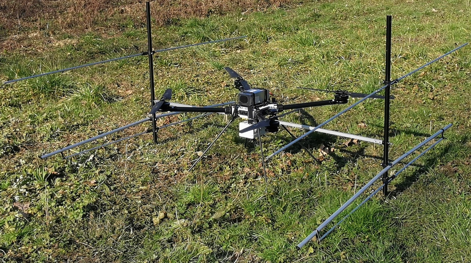
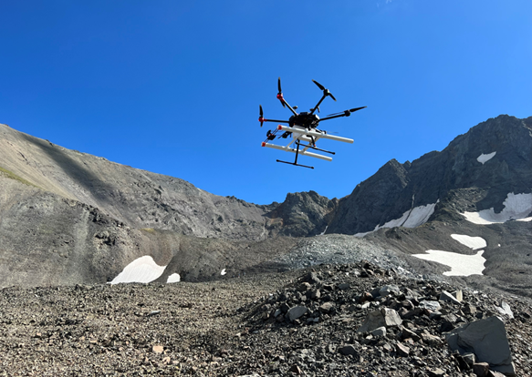
The possibility and feasibility of future drone-based shallow subsurface GPR radar survey for Mars have been examined. Various observations indicate shallower features are present on Mars, could be surveyed ideally from a low altitude flying airborne GPR with survey around 100 MHz transmitted frequency. Although there are uncertainties especially related to the role of iron-oxides – but in general better and deeper penetration is expected for the radar signals than it is characteristic on the Earth. The proposed instrument will be able to explore discontinuities in the underground to measure thickness, volume and stratigraphic sequence.

Introduction

This project aims to evaluate the feasibility and realization of a small mass drone based GPR survey on Mars to support next missions. Range of scientific questions on tectonics, volcanism, climate changes, water and ice could be answered of partly clarified with better knowledge on the shallow subsurface of Mars – all are ideal targets for GPR analysis. The discoveries of shallow subsurface ice on Mars (Dundas et al. 2021, Morgan et al. 2021, Mouginot et al. 2012, Schiff and Gregg 2022), and the mapping of these deposits (Putzing et al. 2023, Morgan et al. 2021), make shallow subsurface region especially important recently. While the top surface is influenced by UV- plus charged particle irradiation, as well as heavily oxidized, the few meters deep region is not influenced by these effected, thus ideal for the acquisition of astrobiology relevant samples.

Radar observations are important for Mars and based on the former MARSIS (Jordan et al. 2009, Picardi et al. 2004, Seu et al. 2007) and SHARAD instruments used from orbit, the RIMFAX instrument onboard the Perseverance and RoPeR instrument onboard Zhurong rovers could provide a range of such discoveries. Internal structure of the polar caps (Jawin et al. 2022), thickness so some depositional units (Li et al. 2022), occurrence of buried ice masses (Nerozzi and Holt 2019) have already demonstrated the success of GPR-like technology for Mars.

Targets on Mars

it is expected that the shallow subsurface consists mainly porous basaltic materials together with various salts beside sedoments. The porous voids if filled by brine or ice could increase electrical conductivity and cause strong radar reflection (Stillman et al. 2022). Porosity exhibits an elevated value at shallow depths in the regolith. Using InSight mission pores are expected to be closed around 9 km depth (Gyalay and Nimmo 2022), and close to the surface the porosity might be up to about 50-60% (Grott et al. 2022). Brines are expected also on Mars, permittivity of salty solutions depends on temperature. Brine mixtures in JSC Mars-1 regolith simulant also show a range of permittivity values depending on temperature and concentration (Kobayashi et al. 2023).

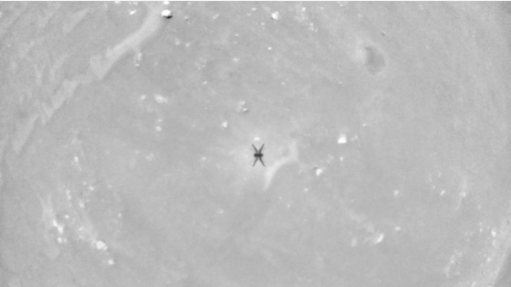
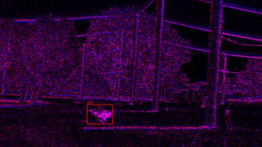
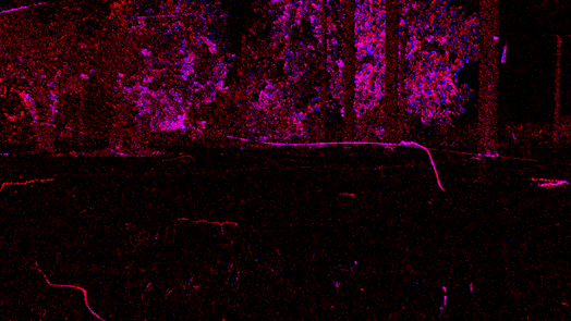
Considering the morphology of target features, surveying about HiRISE images the existence of subsurface structures in the top 10-20 m layer. Some examples are indicated in Figure 1.

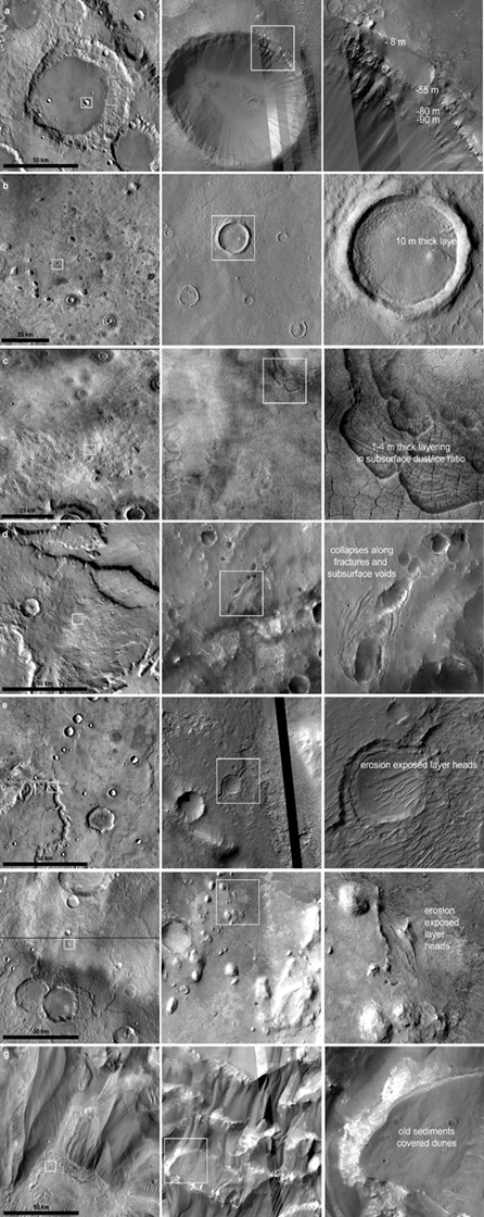
Figure 1: Surface exposed shallow subsurface structures on HiRISE images. First column shows 100 km diameter terrain using THEMIS images for context, second column shows about 4 km diameter part of the HiRISE images, while third column shows 1x1 km magnified section of the images.

Required technical parameters

Aiming the top 1-40 m of the Martian regolith the wavelength range 100-200 MHz is idel. The spatial resolution is expected in the range of meters horizontally (controlled by the pulse frequency and UAV (drone) velocity). Duricrust, hydration-related mineral filled voids and air-filled voids are expected (Spray 2004). Earth based studies showed iron-oxide lower wave velocity, bound water content also has an effect, controlling permittivity (Van Dam et al. 2002).

Identification of bulk liquids water might be moderately straightforward (Wu et al. 2019), as it absorbs the radar signal – but could be rare or absent on Mars today. Thus radar signal could penetrate deeper on Mars than in the case of the Earth. The elevated abundance of iron containing minerals on Mars could potentially affect the interpretability of GPR signal by signal attenuation caused of magnetic minerals (Heggy et al. 2001) could still be too provide useful data (Pettinelli et al. 2007).

Considering such a “FlyRadar” mission with the technical capabilities listed above, an airborne shallow subsurface radar would provide range of new information on ice content of indurated dunes, internal layering of fluvial deposits, mid- and high latitude ice, former crater lake sediments, lava caves, and subsurface tectonic structures and volcanic plumbing systems, or source region of volcano-ice interaction.

Conclusions

Drone based GPR survey on Mars could explore a poorly known domains: large (10-100 km) size area at 1-50 m shallow subsurface, what is and was in close contact with the atmosphere and volatile circulation. Enhanced mobility and accessibility even at rough, steep and dangerous areas are supported by drone-based survey. Rapid mapping of large areal in a short period with repeated observations at different daily and seasonal cycles would provide unique results.

For drones there are limitations on the size and weight of the antenna that can be carried, 100 MHz looks to be ideal. Additionally, at these wavelengths, the attenuation of the electromagnetic waves in the Martian subsurface is still acceptable, based on the attenuation at frequencies of SHARAD and MARSIS.

Acknowledgement

This work was supported by the FlyRadar EU project (No 101007973). The support from Internal fund from Thales Alenia Space Italia is also acknowledged.

References

Dundas et al. 2021. JGR 126, e06617.

Grott et al. 2021. 52nd LPSC #1237.

Gyalay and Nimmo 2022. 53rd LPSC #1633

Heggy et al. 2001. Icarus 154, 244–257.

Jawin et al. 2022. GRL 49, e99896.

Jordan et al. 2009. PSS 57, 1975–1986.

Kobayashi et al. 2023. Earth, Planets and Space 75, id.8.

Morgan et al. 2021. Nat Astron 5, 230–236.

Mouginot et al. 2012. GRL 39, L02202.

Nerozzi and Holt 2019. GRL 46, 7278-7286.

Pettinelli et al. 2007. IEEE Trans. 45, 1271-1281.

Schiff and Gregg 2022. Icarus 383, 115063.

Spray 2004. AGU, id.P33B-05

Picardi G. et al., in Mars Express, ed. by Wilson and Chicarro. SP-1240 (ESA, Noordwijk, 2004), 51–69.

Putzig 2017. 5th International Planetary Dunes Workshop #3054.

Seu et l. 2007. JGR 112(E5), E002745.

Stillman et al. 2022. JGR 127, E007398.

Van Dam et al. 2002. Geophysics 67(2):536-545.

How to cite: Kereszturi, A., Ori, G. G., Dias Marques, N. K., Grandjean, P., Allemand, P., Steinmann, V., Alberti, G., Mastrogiuseppe, M., Gurgurewicz, J., Kofman, W., Mege, D., Orlanducci, C., Tesson, P.-A., Kokin, O., and Augier, S.: Drone based GPR survey on Mars – targets and expectations from a “FlyRadar type” mission, Europlanet Science Congress 2024, Berlin, Germany, 8–13 Sep 2024, EPSC2024-376, https://doi.org/10.5194/epsc2024-376, 2024.

17:25–17:35
|
EPSC2024-1058
|
ECP
|
On-site presentation
Osip Kokin, Akos Kereszturi, Aino Kirillova, Pascal Allemand, Daniel Mège, and Gian Gabriele Ori

On April 19, 2021, the first controlled extraterrestrial flight of a drone, or unmanned aerial vehicle, took place on Mars. This drone, also known as the Mars helicopter, was produced as part of NASA's Mars2020 mission and is called Ingenuity, nicknamed Ginny. It demonstrated that flight is possible in Mars' extremely thin atmosphere, ushering in a new stage of exploration of Mars (drone-based stage). Currently, drones such as Mars Sample Recovery Helicopters (NASA) and Martian Boundary Layer Explorer (MARBLE; Indian Space Research Organization) are being developed for use in upcoming missions. It is obvious that the use of these drones in particular and drones in general in the exploration of Mars will provide new information and data, and perhaps even revolutionize certain areas of research.

This paper discusses the potential of drone usage to study so-called viscous flow features (VFFs) which are widespread in the mid-latitudes of Mars with the maximum density between ∼30° and ∼50° N and S. This term is used as “an umbrella term for all glacial-type formations exhibiting evidence of viscous flow” (Souness et al., 2012). Their surface morphology is represented by lineation, ridges, troughs, mounds and pits (oriented both parallel and transverse to the slope). Rock glaciers and debris-covered glaciers are considered analogues of the VFFs on Earth (Squyres, 1978; Holt et al., 2008).

Results from the Shallow Radar (SHARAD) on board the Mars Reconnaissance Orbiter showed that the bulk of the LDA reveal radar properties entirely consistent with massive water ice (Holt et al., 2008). This fact makes VFFs part of the Martian cryosphere, so their study is one of the most important issues in the research of Mars, and they also could be a source of water for future human exploration in situ, as well as a source of hydrogen and oxygen for fuel. Besides, ice contains historical records of climatic and geologic changes and can preserve ancient microbial life or even living organisms. However, there are still no detailed studies on the thickness and structure of the VFF cover. The use of drones, or unmanned aerial vehicles (UAVs), on Mars, could partially fill this gap and also help in preparing the future missions to drill interpreted VVF ice at further stages of the Mars exploration. Therefore, in this work we discuss what types of observations could a drone make on mid-latitude VFFs.

1. High-resolution images (aerial view). Currently, the highest-resolution images of VFFs are HiRISE images (0.25 m/pixel). Thus, only large boulders and blocks can be identified on them. The main disadvantage of HiRISE images is the limited spatial coverage, which does only partially cover VFFs. The use of drones at further stages of the Mars exploration could improve resolution and partially solve the problem of limited spatial coverage. UAVs makes possible acquisition of images of resolution up to several centimetres per pixel (and even more detailed, depending on the camera and survey height). It makes possible to estimate the proportion of coarse fractions (pebbles and small boulders) in the surface sediments covering the supposed ice. Spatial coverage encompasses the entire object of interest, not just part of it, but only in the area of rover landing and/or operation. An important advantage is that the drone can fly over places that are inaccessible to rover exploration.

2. Digital terrain models (DTMs) and 3D topography. Typically, DTMs derived from HiRISE imagery can achieve vertical resolution ranging from a few meters, depending on the specific terrain and the accuracy of the processing methods. Horizontal resolution is generally determined by the original imagery's resolution, which is around 50 centimetres per pixel for HiRISE images. DTMs generated from high-resolution drone imagery are able to achieve better resolution (from a few centimetres to several decimetres both vertical and horizontal). The main advantage of drones is the ability to use ground control points with known coordinates and elevations for georeferencing of images and elevation data. Geometrically corrected aerial images (orthophotos) draped over the DTMs will create informative and visually appealing high-resolution 3D topography. DTMs and 3D topography generated from drone imagery can be used for accurate and detailed measurements as well for studying small-scale landforms of VFF surfaces. They will provide new information on the processes and dynamics of VFF deposits formation and will allow a better understanding of their cover origin.

3. Ground penetrating radar (GPR) profiling. This is probably one of the main tasks on the way to searching for subsurface water and ice on Mars. Radar data on the structure of the upper part of the crust obtained from orbit (SHARAD, MARSIS) provide information only deeper than 15-50 m from the surface. Metre – decimetre scale spatial resolution of radar data for studying the uppermost subsurface is challenging and could not be gained from orbit, but close to the surface. However, the mobility of rovers is limited, and their scanning capabilities are limited to thin lines over a moderate distance. In contrast, a drone-based GPR survey has the potential to overcome these limitations. It can cover larger areas and provide more flexibility in data collection. GPR survey will provide information on the thickness of sediments covered the ice, the thickness and internal structure of the ice, as well as stratigraphic correlation with adjacent units.

All these types of observations will be useful for choosing site to drill ice at further stages of the Mars exploration. In addition, they will provide a better understanding of VFF origin. To implement them, there is a number of challenges related primarily to the remote control of the drone and limitations on the data transmission rate between the drone, the rover, and Earth. However, the first experience of using a drone on Mars (Ingenuity) shows that these challenges can be partially resolved.


Acknowledgement

This work was supported by the FlyRadar EU Horizon 2020 project (grant agreement No 101007973).


References

Holt et al. 2008. Science, 322 (5905).

Souness et al. 2012. Icarus 217, 243–255.

Squyres 1978. Icarus, 34 (3). 600–613.

How to cite: Kokin, O., Kereszturi, A., Kirillova, A., Allemand, P., Mège, D., and Ori, G. G.: Potential of drone usage to study viscous flow features on Mars and their analogues on Earth, Europlanet Science Congress 2024, Berlin, Germany, 8–13 Sep 2024, EPSC2024-1058, https://doi.org/10.5194/epsc2024-1058, 2024.

17:35–17:45
|
EPSC2024-511
|
ECP
|
On-site presentation
Francesca Mancini, Osip Kokin, Gianni Alberti, Pascal Allemand, Philippe Grandjean, Sylvain Augier, Alexandre Castel, Olivier Neir, Titus Senez, Akos Kereszturi, Johanna Gurgurewicz, Wlodek Kofman, Daniel Mège, and Gian Gabriele Ori

Introduction

The goal of the FlyRadar project (a 2020 Horizon 2020 MSCA-RISE project funded by the European Commission) was to design and develop a multimodal Ground Penetrating Radar (GPR) and Synthetic Aperture Radar (SAR), multi-frequency radar system installed on an Unmanned Aerial Vehicle (UAV), tailored for exploration on Mars, and validated through testing on Earth (Figure 1).

Figure 1: The FlyRadar instrument. The radar’s GPS is fixed to the drone’s battery in the center. A GoPro camera was added to film the ground.

A GPR is an active remote sensing instrument that emits electromagnetic waves and detects the waves reflected by discontinuities on the surface of the planet or contrasts in permittivity within its subsurface. Analysis of these echoes yields geometric and geological information about subsurface features, typically penetrating to depth of approximately 100 meters, contingent upon the permittivity of the material being surveyed.

The search for extraterrestrial resources, like ice or water, has been a key scientific objective in the human exploration of the solar system, with Mars being the second closest terrestrial planet and the most likely candidate to have ice/water resources [1]. Airborn surveys will be essential in both robotic and human exploration missions. The FlyRadar consortium's scientific team is also currently involved in some recent space exploration missions such as Mars Ice Mapper [2].

FlyRadar's scientific test campaigns have been planned, with an initial test scheduled in the glacial environment of the Alps followed by testing in the arid environment of Morocco. These tests aim to evaluate the integrated system capabilities in terms of operations and scientific data quality.

Testing area: the Miage Glacier

The Miage Glacier, as the most representative debris-covered glacier in Italy, serves as a crucial site for multidisciplinary scientific research. The Miage Glacier is located in the Veny Valley on the SE flank of Mont Blanc massif in the Alps (Italy, Valle d'Aosta, Courmayeur; Figure 2). Miage is a valley glacier, and it covers an area of 11 km2. The front of the right glacier tongue terminates at an elevation of 1730 m. The glacier is bordered by steep walls and exposed towards south-east.

The entire lower 6500 m of the glacier up to the elevation of 2450 m is completely covered with debris. It is 41,5 % of the total area. Mean slope of the debris cover surface is 6° (for the right tongue). Inner part of debris cover has hummocky surface with a lot of thermokarst depressions sometimes with lakes. Most often, there are no clearly defined ridges, but there are coloured stripes along the glacier in accordance with the debris lithology. The edges of the debris cover are represented by steep slopes. The average value of debris cover thickness is around 20-40 cm (Mihalcea et al., 2008). The maximum value is around 50-60 cm in the lowest parts of the lobes. The debris was accumulated here because of glacial ablation.

Figure 2: The debris-covered Miage Glacier.

Conclusion

Future space missions will extensively use drones for several tasks. It will be important for the analysis of the subsurface for scientific purposes but also for technical reasons (to identify subsurface water or ice, 3D mapping of geological features, to support infrastructure deployment on the surface, identification of resources, etc.). Although drones are going to be applied, there is a gap in space industry regarding the construction of low weight, low energy consumption and robust SAR systems that is exploited by the FlyRadar project. The aim of the FlyRadar project is to develop, test and build a radar system able to work in both GPR and SAR mode installed on board a UAV. Planned tests in glacial and arid areas at analog sites on Earth will aid in refining and optimizing the instrument, establishing a workflow to prepare it for Mars exploration.

Acknowledgement

The FlyRadar project was supported by the EU H2020-MSCA-RISE-2020 Grant agreement ID: 101007973.

References

[1] Nazari-Sharabian M., et al., 2020. Galaxies8(2), p.40.

[2] Amoroso M. et al., 2024. No. EGU24-10754 Copernicus Meetings.

[3] Mihalcea C. et al., 2008. Cold Regions Science and Technology52(3), pp.341-354.

How to cite: Mancini, F., Kokin, O., Alberti, G., Allemand, P., Grandjean, P., Augier, S., Castel, A., Neir, O., Senez, T., Kereszturi, A., Gurgurewicz, J., Kofman, W., Mège, D., and Ori, G. G.: Testing the FlyRadar instrument in glacial environment on Earth for future ice/water investigations on Mars, Europlanet Science Congress 2024, Berlin, Germany, 8–13 Sep 2024, EPSC2024-511, https://doi.org/10.5194/epsc2024-511, 2024.

17:45–17:55
|
EPSC2024-1271
|
On-site presentation
Roberto Aguilar, Tyler Meng, Michael Christoffersen, Stefano Nerozzi, and John Holt

Ground penetrating radar (GPR) is a valuable geophysical technology for imaging the interior of debris-covered glaciers (DCGs) on Mars and Earth. The Shallow Radar (SHARAD, 15-25 MHz) sounder onboard NASA’s Mars Reconnaissance Orbiter confirmed the bulk composition of the DCGs at the mid-latitudes of Mars is water ice [1]. However, internal structure and debris layer thickness, which are of interest for paleoclimate studies and in-situ resource exploration, respectively, are not obtainable with this instrument and would be challenging for any orbital platform [2, 3].

On Earth, GPR has been employed over terrestrial analogs to understand the basic relationships between the composition, structure, flow kinematics, and morphology of similar landforms [4, 5]. This geophysical method penetrates through the debris layer on the surface, allowing for the quantification of the debris thickness, total glacier thickness, ice purity, and the presence of englacial bands. Traditional surface-based GPR has a high signal-to-noise ratio (SNR), but involves slow, manual operations with bulky equipment that renders it less suitable than robotic platforms for future Mars exploration missions.

To address this challenge, we tested a drone-based GPR at two DCGs, Sourdough, Alaska, and Galena Creek, Wyoming. The platform consists of a MALA Geodrone 80 GPR system mounted on a DJI Matrice 600 Pro (Figure 1). To maintain a constant speed and altitude over an uneven surface, we use a UgCS SkyHub terrain-following system consisting of an altimeter and a distance sensor for obstacle avoidance. The GPR antennas should be as close to the ground as possible to maximize the SNR, so we conducted surveys starting at 1.5 m above the ground. However, due to the roughness of the terrain, steep slopes, and the presence of large boulders, most of the surveys have been performed at altitudes between 2 and 3 m to reduce the risk of collision, at a flight speed between 0.5 m/s and 1 m/s.

Our findings suggest that the drone-based GPR can resolve the debris/ice with acceptable SNR and thus accurately measure the debris thickness. Also, it is possible to detect the bedrock in sections where the glacier is thinner. Additionally, drone-based GPR also resolved these reflectors at the cirque of Galena Creek, where surface-coupled GPR had identified englacial debris bands.

In conclusion, our system is a promising method for surveying rock glaciers on Earth. As for planetary exploration, the study of robotics-based radar platforms aligns with the interests of developing uncrewed missions to Mars. For instance, the Mars 2020 mission includes a GPR as part of the instruments onboard the Perseverance rover, and Ingenuity, a successful demonstration of autonomous powered flight on Mars.


References


[1] Holt,  J. W. et al.,  Science, vol. 322.

[2] Baker D. M. H.and Carter L. M. (2019) Icarus, vol. 319.

[3] Aguilar, R. et al. (2024) LPSC LV, Abstract #2479.

[4] Petersen, E. I. et al. (2018) Geophys. Res. Lett., vol. 45.

[5] Meng T. M. et al. (2023) Remote Sensing, vol. 15.

Figure 1. DGPR operations at Galena Creek Rock Glacier, Wyoming. The GPR MALA Geodrone 80 (white box) is mounted on the DJI M600 Pro drone. The length of the antennas is 1.04 m, with a separation of 0.53 m.

Figure 2: Radargrams acquired at lower Sourdough Rock Glacier. (a) Drone GPR at 80 MHz,  ground tracks represented with the yellow line in Figure 1a. (b) Surface-based PulseEkko GPR at 50 MHz, ground tracks represented with the red line in Figure 1a. (c) and (d) are insets of the debris-ice interface from Figure 2a and Figure 2b, respectively.

How to cite: Aguilar, R., Meng, T., Christoffersen, M., Nerozzi, S., and Holt, J.: Subsurface Investigations of Debris-Covered Glaciers as Mars Analogs with Drone-Based Ground Penetrating Radar, Europlanet Science Congress 2024, Berlin, Germany, 8–13 Sep 2024, EPSC2024-1271, https://doi.org/10.5194/epsc2024-1271, 2024.

17:55–18:00