SB7
Advances in Photopolarimetry and Spectropolarimetry of Solar System Small Bodies
Convener:
Oleksandra Ivanova
|
Co-conveners:
Ludmilla Kolokolova,
Irina Belskaya,
Yuna Kwon,
Karri Muinonen,
Stefano Bagnulo,
Johannes Markkanen,
Zuri Gray,
Olena Shubina
Orals MON-OB2
|
Mon, 08 Sep, 09:30–10:30 (EEST) Room Earth (Veranda 2)
Posters MON-POS
|
Attendance Mon, 08 Sep, 18:00–19:30 (EEST) | Display Mon, 08 Sep, 08:30–19:30 Finlandia Hall foyer, F150–154

Session assets
09:42–09:54
|
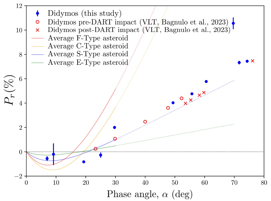
EPSC-DPS2025-1767
|
On-site presentation
09:54–10:06
|
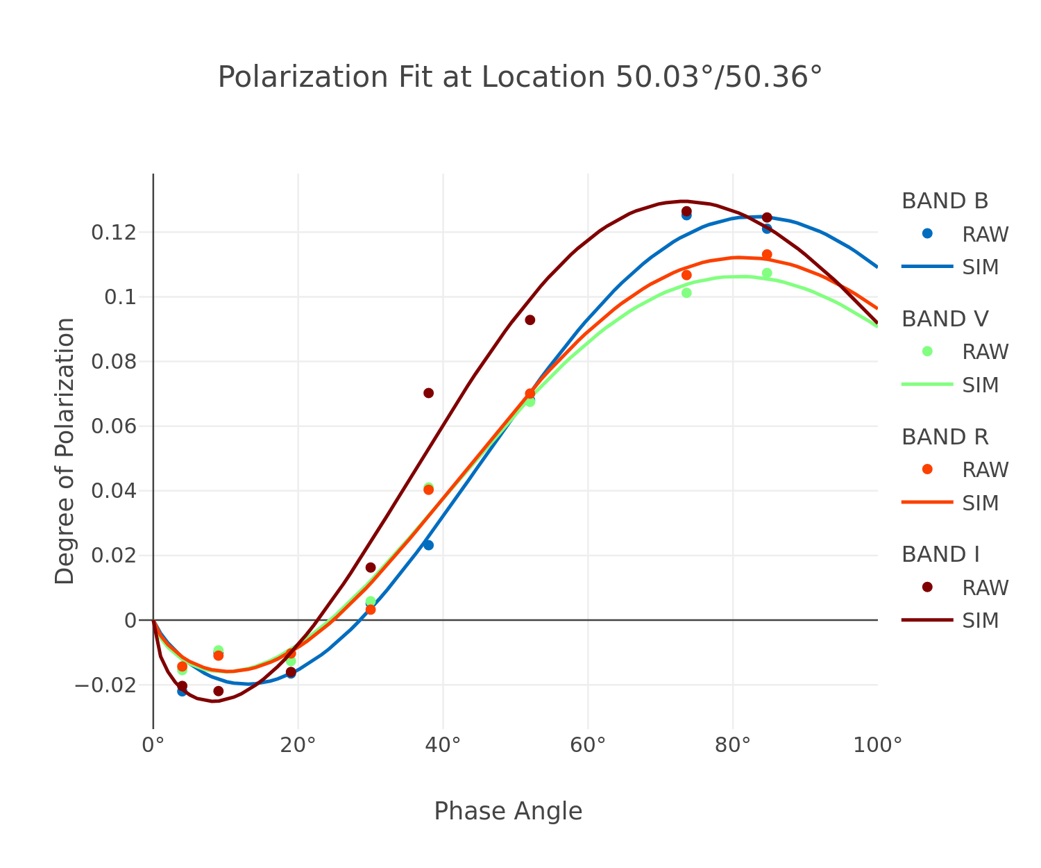
EPSC-DPS2025-1565
|
ECP
|
On-site presentation
10:06–10:18
|
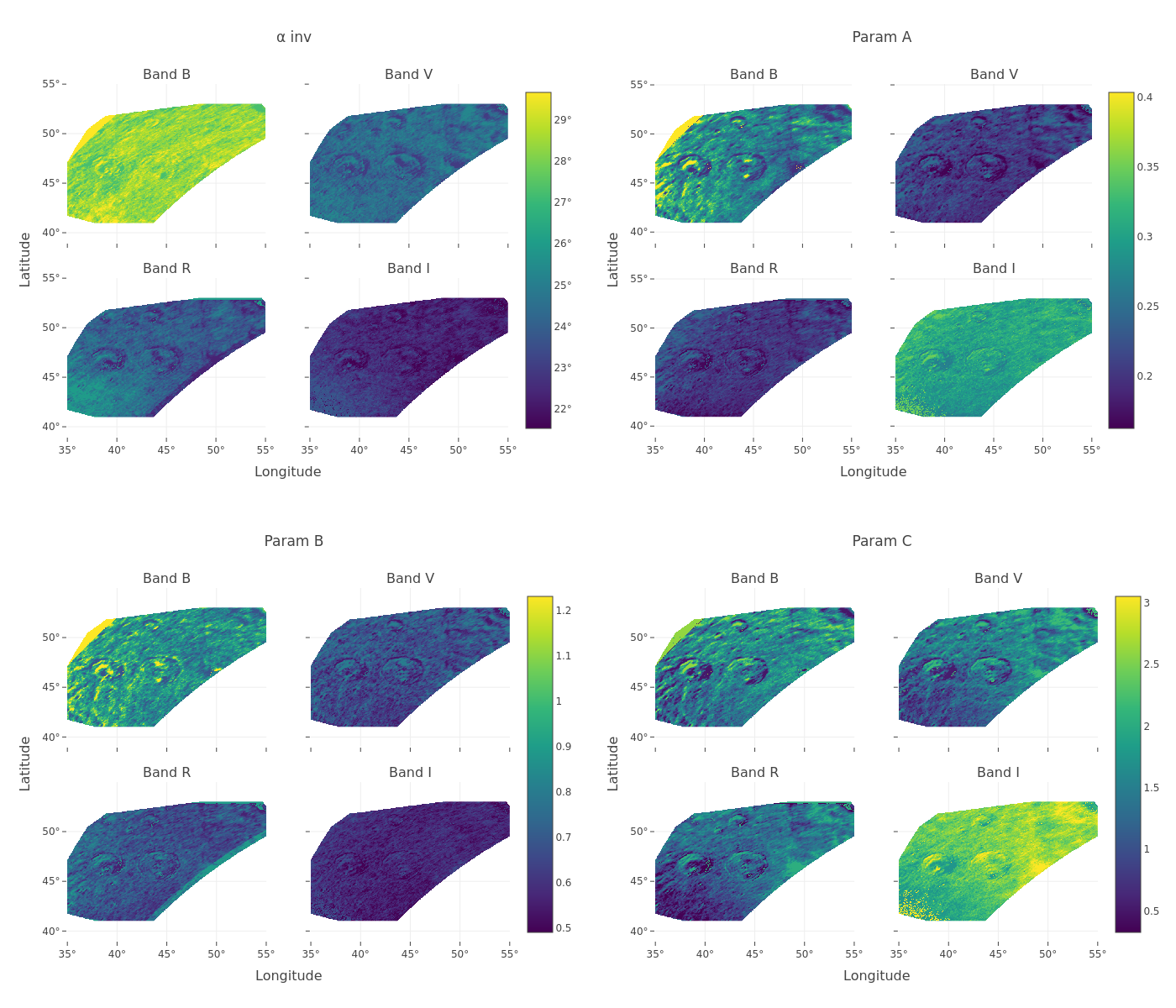
EPSC-DPS2025-1232
|
ECP
|
On-site presentation
10:18–10:30
|
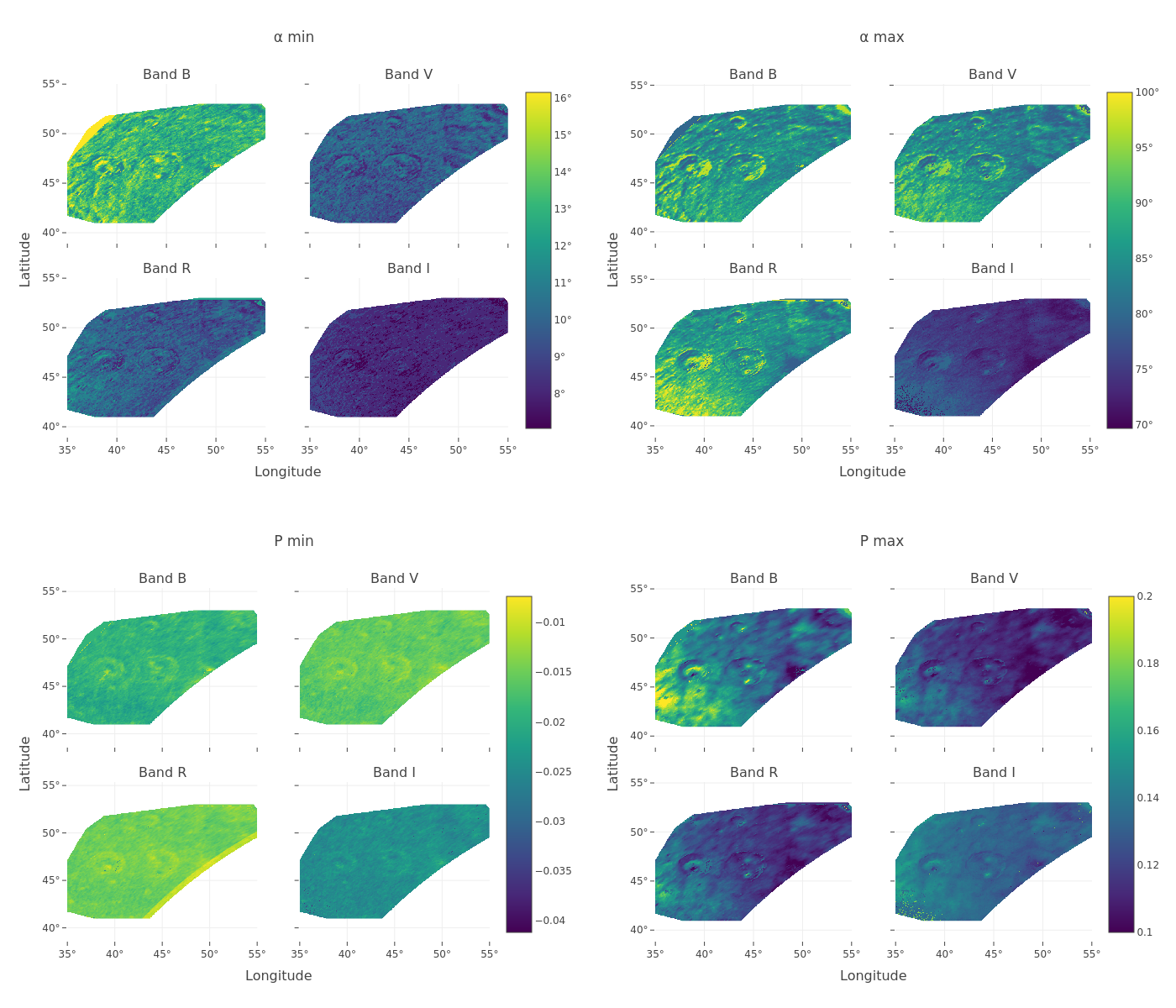
EPSC-DPS2025-597
|
ECP
|
On-site presentation
F150
|
EPSC-DPS2025-482
|
On-site presentation
F151
|
EPSC-DPS2025-579
|
ECP
|
On-site presentation
 .
. 
F152
|
EPSC-DPS2025-1126
|
ECP
|
On-site presentation
F153
|
EPSC-DPS2025-1268
|
On-site presentation
F154
|
EPSC-DPS2025-2083
|
ECP
|
Virtual presentation